Get Full Government Meeting Transcripts, Videos, & Alerts Forever!
Get email alerts on the Land Use Subdivision topic
No spam. Unsubscribe anytime.
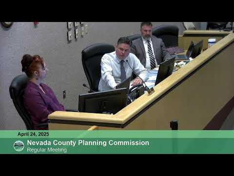
Planning commission recommends limited extension for South Woodlands subdivision amid fire‑safety debate
Summary
Nevada County planning staff recommended, and the Planning Commission voted to recommend to the Board of Supervisors a time-limited development agreement extending the South Woodlands vesting tentative final map; commissioners and the applicant debated the length of the extension and fire‑safety and public‑benefit conditions.
The Nevada County Planning Commission voted to recommend that the Board of Supervisors approve a development agreement extending the life of the previously approved South Woodlands vesting tentative final map for an initial three years with two potential three‑year extensions.
David Nicholas, associate planner for Nevada County, told the commission the development agreement does not alter the map itself but would extend the map’s expiration. He summarized the approved subdivision as “a project to subdivide 152 acres into 30 residential lots ranging in size from 1.7 acres to 20.3 acres” and said most lots would be served by treated public water from NID, with two served by wells and all by individual septic systems. The original tentative map was approved on March 10, 2016, and discretionary extensions and an automatic state extension have moved the current expiration to September 10, 2026, under staff’s accounting.
Nicholas told commissioners the Planning Department recommended a shorter extension than the applicant requested because the county’s development agreement findings ordinarily require public benefits beyond minimum code requirements. “Staff recommend that the development agreement extend the life of the South Woodlands map for 36 months with up to 6 years of extensions,” he said, and explained the recommendation was intended to provide a timeline equivalent to what a newly approved map would receive today, without relieving the applicant of current standards where practicable.
Andy Casano, a professional planner and land surveyor representing the Shadskegos Trust, argued the project and its original conditions represent public benefit and fairness compared with other subdivision development agreements the county has approved. Casano said the subdivision would create an emergency access connection between Greenhorn Road and Idaho‑Maryland Road and noted existing water infrastructure: “This is a rare rural project that has treated public water, NID treated public water. There are fire hydrants in parts of that property already.” He asked the commission to recommend a longer initial term similar to other projects the county previously allowed.
Commissioners pressed both staff and the applicant about what additional public benefits the county sought. Staff listed possible items that would have supported a longer extension, including meeting current Fire Safe Road standards for the emergency access, adding fire hydrants or water storage, dedicating land for conservation easement, or committing to affordable‑housing measures. Casano said the applicant was generally open to some concessions — he mentioned junior accessory dwelling units as feasible — but said constructing the long emergency access road in advance, before the rest of development, “would be very tough” and may not be financially feasible unless the developer was committed to completing the entire project.
Representing the Nevada County Consolidated Fire District, Robert Tellum said the district did not support the applicant’s proposed long extension due primarily to the length of time requested and the fact that building and fire codes change regularly. Tellum said, “The building codes and fire codes change every 3 years,” and that long extensions create uncertainty for fire and public‑safety planning.
After discussion, the commission voted to recommend the Board of Supervisors find the original mitigated negative declaration adequate and to recommend adoption of an ordinance approving a development agreement allowing an additional three years with two potential three‑year extensions. Roll calls on both motions recorded Commissioners McAteer, Foley and French and Chair Millman voting yes on the recommendations.
The commission and applicant also discussed the emergency‑access road at length: staff and commissioners described it as the project’s chief public benefit if constructed, while the applicant said some steep portions could not feasibly meet current width/grade standards without significant earthwork and retaining structures. Casano said a critical steep portion is about “500 feet” and that some existing roadbed, pipes and hydrants are already in place along parts of the route.
The commission’s recommendation to the Board of Supervisors will be transmitted with staff’s suggested conditions; the Board will take the final action on the development agreement and any ordinance.