Get Full Government Meeting Transcripts, Videos, & Alerts Forever!
Get email alerts on the Flooding And Stormwater topic
No spam. Unsubscribe anytime.
County hears consultants’ countywide flood‑risk mapping options after resident reports repeated driveway and road flooding
Summary
At a Rockwall County workshop April 20, a resident reported recurring flooding on Dow Road and engineers from Pape Dawson recommended countywide 2D flood‑risk modeling and optional regulatory steps to identify unmapped urban flood risks and guide mitigation, early warning and development review.
A Rockwall County resident told the Commissioners Court April 20 that new nearby development has redirected runoff across his property and into a levee breach, and county-hired consultants from Pape Dawson Engineers presented a proposal for countywide flood‑risk mapping and related tools to identify and manage similar unmapped urban flooding.
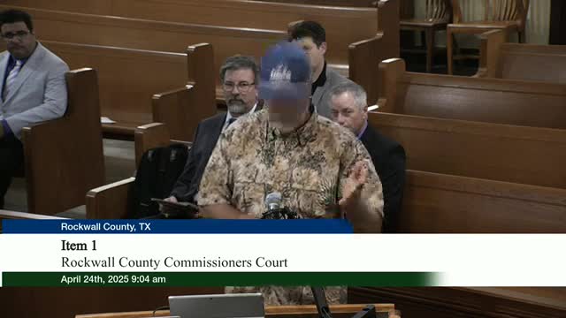
John Thomas, who identified himself during the public forum as a resident on 494 Dow Road, said a subdivision built uphill over the last several years has raised grade and altered historical sheet flow. "The levee obviously that's behind us, it's breached," Thomas said, describing a 4‑inch culvert the original landowner installed and recent water depths of roughly 4 to 5 inches across his driveway and in the road after heavy rain. He said he and neighbors have raised concerns with planning and zoning officials but are still experiencing repeated flooding.
The presentation that followed, led by Michael Welbaum, vice president of Pape Dawson Engineers, and by Zubin Suswala and Lonnie Anderson of the company's drainage team, outlined methods and software the firm uses to map both FEMA‑regulated riverine floodplains and the more numerous but typically unmapped urban sheet‑flow areas. "The point of this is to talk about flood risk assessment, what tools are available, and and how can we do that in an economic, fashion," Welbaum told the court.
Why the proposal matters: FEMA flood maps typically start at drainage basins of about 1 square mile and therefore omit many smaller urban flow paths that nevertheless cause most residential flood insurance claims. Suswala, managing vice president for Pape Dawson's Dallas office, cited national data showing 60–70 percent of FEMA claims occur outside FEMA's mapped 100‑year floodplain. He said newer two‑dimensional (2D) modeling can produce a countywide map of likely flood depths and flow paths that captures that unmapped risk and can be updated as development and terrain data change.
What the consultants proposed and demonstrated
- Approach and tools: The firm recommended a layered, scalable program using HEC‑RAS 2D (free U.S. Army Corps of Engineers software accepted by FEMA) combined with high‑resolution terrain (lidar), building footprints, land‑cover/imperviousness and existing storm‑drain data where available. Anderson, Pape Dawson’s practice leader for drainage, demonstrated how 2D models route rain on the terrain into channels and across streets, saying, "I can make these models so detailed that I can move the potted plant from 1 side of my patio to the other and it'll show a difference in water surface."
- Products and applications: The firm described outputs including maps of areas likely to exceed specified depths (consultants displayed results for depths greater than one half‑foot), flood‑inundation animations, depth×velocity risk layers, and early‑warning thresholds for low‑water crossings. They showed examples from Fort Worth, Harris County and Corpus Christi where 2D modeling helped explain why properties flooded and informed mitigation choices.
- Costs and scale: The presenters gave a rule‑of‑thumb cost range based on past projects: roughly $1,000–$1,500 per square mile for large county projects with good baseline data, and higher per‑mile costs for smaller areas where setup and data collection are proportionally larger. The software itself (HEC‑RAS) is free, the firm said; most cost is staff time, data assembly and calibration.
Regulatory and policy implications discussed
Commissioners asked whether a county could use such maps to regulate development in areas outside FEMA floodplains. Suswala and Anderson said counties can adopt drainage criteria based on detailed flood‑risk mapping and that several Texas jurisdictions have incorporated higher local standards than FEMA’s minimums. "You would have to create drainage criteria and you would have to know what that orange area looks like," Suswala said, referring to non‑FEMA urban flood risk areas. The presenters emphasized that a countywide model also can be used in a less prescriptive way—as advisory mapping, a basis for developer review standards, or as a tool to prioritize capital projects such as low‑water crossings or conveyance improvements.
Next steps and court directions
Court discussion identified several practical next steps: the consultants agreed to provide their presentation and model examples to the county; the commissioners said the county engineer (expected to begin work in two weeks) should review the material; and several officials said they want legal and policy analysis before adopting any new regulatory standard countywide. No formal votes or regulatory changes were taken at the workshop.
Context and background
Presenters referenced recent flooding events and prior mapping efforts (including FEMA and a TWDB base level engineering product) and noted that remapping through FEMA can be slow; county or city models can be used in the interim for planning and permitting. They also cited forensic post‑storm work where 2D models helped explain flood causes—examples included August 2022 storms in the region and other recent Texas localities.
The court recessed briefly during the presentation and reconvened; the workshop adjourned at 11:11 a.m.
Ending note: Commissioners asked Pape Dawson to share slides and example viewers used elsewhere; county staff and the incoming county engineer will review the materials and consult counsel on legal authority before deciding whether to fund or adopt countywide modeling or regulatory changes.