Get Full Government Meeting Transcripts, Videos, & Alerts Forever!
Get email alerts on the Wetlands Stormwater topic
No spam. Unsubscribe anytime.
Lakeville commissioners pause 160 Bedford stormwater plan, order wetland re‑delineation and peer review
Summary
The Lakeville Conservation Commission continued review of engineering plans for 160 Bedford Street and Rear Bedford Street and asked applicants to reflag wetlands and secure an independent peer review after finding the wetland lines unconfirmed and the stormwater design incomplete.
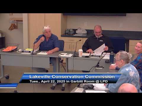
The Lakeville Conservation Commission continued review of proposed stormwater work at 160 Bedford Street and Rear Bedford Street on April 22, directing the applicant to reflag wetland boundaries and authorizing a peer review of the wetland delineation and stormwater design.
Commission staff and a stormwater peer reviewer told the commission that the property’s wetland lines were not currently approved and that the engineering submittals lacked detail needed to confirm a compliant design. Deb Keller, who said she conducted the commission’s stormwater peer review, told the commission, “the one thing I don't think the board knows is that none of the wetland line has been approved.” She said the project file shows an earlier RDA/ORAD history that was not carried forward and that an August 2023 submittal led the commission to require a Notice of Intent rather than accept the earlier line.
The lack of an approved wetland boundary, Keller said, prevents accurate impact measurement and leaves the commission unable to confirm whether proposed grading, a basin and other stormwater features are inside regulated buffer areas. Keller flagged additional technical issues in the drainage model and raised questions about whether the basin design had sufficient subsurface test pits to confirm groundwater interaction. “I would almost think we'd want to have that information now rather than later,” she said, arguing that confirmatory soil and groundwater data should be collected before the commission approves an Order of Conditions.
Commission members and Keller also discussed field conditions and enforcement actions. Keller and staff described piles of reclaimed asphalt and crushed material on the property, the presence of prior enforcement orders and a cease-and-desist, and test-pit results showing elevated metals (arsenic and copper) in some locations. Keller said the project team had proposed a new treatment approach — a so‑called “pig” or pig blanket — but that the design and anchoring approach required further review and manufacturer consultation to ensure it would not cause upstream flooding under high-flow events.
Applicants’ representatives told the commission they do not have a finalized long-term development program for the site and that, aside from the current work to address identified contamination and stormwater, no building plans are imminent. Kenny Comfort, who identified himself as the owner’s representative, said, “there is absolutely nothing that’s on the table as far as long term use of what the property is gonna be.” The lack of a defined future use was one reason Keller and commissioners said the plans should clearly show any assumed future pavement or building footprints so the basin can be evaluated for the full predicted pollutant load.
After discussion, the commission and staff agreed to require the applicant to flag the wetland boundaries in the field and to secure an independent wetland‑delineation peer review. Commissioners named two consultants used historically by the commission — Brad Holmes of Environmental Consulting and Restoration and Brandon Fook — as possible reviewers. The commission continued the matter to the board’s May 13 meeting to allow time for reflagging and peer‑review scheduling.
Why it matters: the property is adjacent to multiple wetland resources and a channelized off‑site drainage path; inaccurate boundaries or incomplete stormwater designs could affect downstream wetland and residential properties. Commissioners emphasized that approving a basin or other work without confirmed flagging and adequate groundwater and modeling data risks further modifications and repeat reviews later.
What the commission asked for and next steps: the commission will require (1) field reflagging of all wetland boundaries on the parcel (front and rear), (2) a peer review of the wetland delineation and stormwater design by a qualified wetland scientist and/or engineer, (3) clarifying test‑pit data for the basin footprint (to confirm groundwater interaction), and (4) clearer plans that show any assumed future pavement or building footprints that informed the stormwater design. The commission continued the item to May 13, 2025, at 6:30 p.m. at the Lakeville Police Station.
Participants and quotes in context: Deb Keller of Merrill Engineers and Land Surveyors, who performed the stormwater peer review, led the technical presentation and repeatedly recommended additional test pits and clarifications. Mark Minton, Lakeville’s conservation agent, coordinated the commission’s field and peer‑review logistics. Kenny Comfort, the owner’s representative, said the owner has not yet settled on a long‑term development plan for the site. Several residents and abutters spoke during the meeting, describing visible grading, storage of material and flooding concerns downstream.
No formal permit was issued; the commission’s recorded action was to continue review pending reflagging and peer review.