Get Full Government Meeting Transcripts, Videos, & Alerts Forever!
Get email alerts on the Land Use Zoning Transects topic
No spam. Unsubscribe anytime.
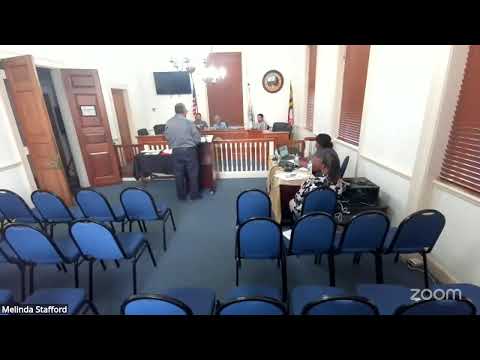
Pocomoke planners debate transect-style zoning, —ish— missing-middle housing and a proposed 74-acre overlay
Summary
Planning commissioners reviewed a consultant raft land-use chapter that introduces 'transect' zoning and broader allowance of middle-housing types. Commissioners supported refining boundaries and localizing recommendations, and discussed creating a floating mixed-use overlay for a 74-acre city-owned tract.
Pocomoke City planning commissioners spent the bulk of a work session examining a consultant raft land-use element that would reorganize existing zoning into a "transect" framework and expand allowances for middle-housing types such as townhouses, duplexes and accessory dwelling units.
The consultant's draft proposes six transect categories (T1 central business, T2 core neighborhoods, T3 fringe neighborhoods, T4 suburban, SDC commercial and SDI industrial) that reclassify parts of the city by proximity to the downtown core and intended density. The presenter and commissioners agreed the concept has merit but warned the proposed implementation is broad and risks community pushback unless it is tailored to local conditions.
"This is somewhat of a radical approach," Speaker 2 said, summarizing the consultant's framing, and added that "the devil is in the details" when it comes to allowing higher-density and mixed housing types across residential transects.
Commissioners raised several implementation concerns and clarifying points:
- Boundary adjustments rather than wholesale replacement: Several speakers said the transect map largely mirrors existing zones and recommended tweaking boundaries and definitions rather than replacing the city's familiar zoning categories outright. "You could utilize our existing zoning model and modify it rather than presenting a completely new zoning model," Speaker 1 said. - Missing-middle and neighborhood compatibility: Commissioners supported the concept of adding townhouse, duplex and accessory-dwelling-unit options in parts of the city, but urged careful limits to avoid tearing single-family neighborhoods apart. One commissioner said permitted conversions in the past had hurt property values when owner-occupancy and design standards were not enforced. - Where to allow multifamily: The consultant draft eliminates a separate multi-family (R3) district and instead suggests allowing apartments across several transects; commissioners asked the staff and council to clarify where new construction of multifamily housing would be appropriate. - Local corrections to the land-use map: Several parcels near Market Street extension, the Armory block and other downtown lots were flagged as misclassified on the consultant's map and in earlier city maps; staff noted some of those are already corrected in the consultant raft but asked commissioners to identify other parcels that warrant amendment. - Floating mixed-use overlay for large vacant parcels: Staff told the commission the mayor and council had asked staff to explore a mixed-use overlay for a 74-acre city-owned tract. Staff said such an overlay could be considered through a planned-unit-development or redevelopment overlay ordinance and could be brought to the planning commission for review as soon as next month.
On infrastructure and fiscal impacts, commissioners noted that concentrating higher density in the downtown core would better leverage existing streets, sidewalks and utilities, while suburban sprawl increases per-parcel infrastructure costs. The presenter argued that encouraging density in the core yields better returns on city maintenance budgets.
Commissioners also discussed process mechanics: potential demolition or redevelopment timelines (the city code currently allows 12 months to commence work on a property; some commissioners suggested aligning with the International Building Code and changing the timeline to six months) and neighborhood compatibility rules, ADU standards and potential reductions in minimum dwelling unit size.
No formal zoning changes were made at the session. The commission directed staff to provide written feedback to the consultant, to flag misclassified parcels for map correction, and to prepare draft overlay language for the 74-acre tract for consideration at a future meeting. Commissioners emphasized public engagement, saying a wholesale rebrand of zoning terminology would be harder for the public to accept than a localized set of targeted code updates.
Staff planned to return a revised draft that maps transects to existing city zone categories and offers specific, limited allowances for middle housing in defined areas rather than a blanket permission across all transects. The commission scheduled continued review at upcoming work sessions and discussed including the consultant in a later public presentation or using Zoom for engagement.