Get Full Government Meeting Transcripts, Videos, & Alerts Forever!
Get email alerts on the Transportation Road Reconstruction topic
No spam. Unsubscribe anytime.
Committee backs hybrid design for State Highway 52 (E. Wausau Ave.), adopting center turn lane downtown and multiuse path to the east
Summary
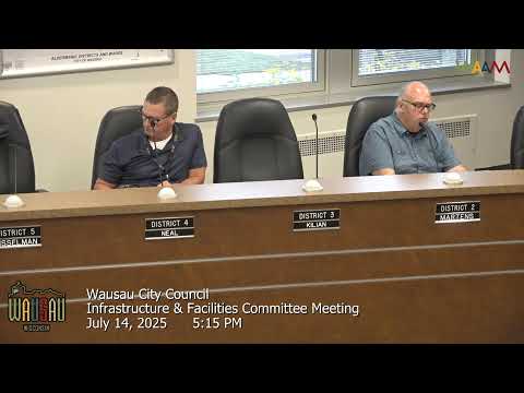
The City of Wausau Infrastructure and Facilities Committee on Aug. 14 approved a hybrid redesign for State Highway 52 (East Wausau Avenue), keeping a continuous two‑to‑one center turn lane from Sixth to Thirteenth Street and transitioning to separated travel lanes with a 10‑foot multiuse path from Thirteenth to Eighteenth Street.
The City of Wausau Infrastructure and Facilities Committee on Aug. 14 adopted a split approach to the State Highway 52 (East Wausau Avenue) reconstruction, voting to install a continuous two‑to‑one center turn lane from Sixth Street to Thirteenth Street and to transition to a section with separated travel lanes and a 10‑foot south‑side multiuse path from Thirteenth Street to Eighteenth Street. The committee’s action followed several hours of public comment and technical briefing by city staff and the project consultants.
The committee’s decision implements safety and multimodal goals raised during earlier public meetings and by the Wausau Metropolitan Planning Organization. Chair Hinkie said the intent was to balance “safety hot spots” with bicycle and pedestrian connectivity included in local plans. Alder Larson moved the initial recommendation in favor of Alternative A2 (continuous two‑to‑one), Alder Martins seconded; Alder Watson successfully moved and secured amendments that introduced the transition east of Thirteenth Street. The final motion passed 3–1.
Why it matters: The corridor serves local schools and businesses and has a history of rear‑end crashes between Sixth and Thirteenth Street. The adopted hybrid design prioritizes a continuous center turn treatment where crash clustering was highest while adding a dedicated, separated shared path east of Thirteenth Street to provide a higher‑comfort off‑street route for bicyclists and pedestrians where right‑of‑way permitted. Committee members and DOT staff emphasized continuity with MPO and Safe Routes to School goals.
What the committee heard: Two members of the public who live on or near East Wausau Avenue urged strong protection for cyclists and lower design speeds. Jonathan Smith, speaking from the public podium, reiterated the Bike and Pedestrian Advisory Committee’s recommendation for an 8–10‑foot multiuse trail, 25 mph posted speed, and pedestrian refuges. Joshua Clements, who said his family has lived on East Wausau since 1963, urged a design that would produce a true separated facility rather than paint alone and pressed the committee to design for 25 mph if that is the desired operating speed.
Technical tradeoffs and constraints: Project engineers said both alternatives were developed to comparable engineering detail. The committee was shown that the corridor contains pinch points—particularly around Seventh Street—where commercial buildings and adjacent homes constrain width. That constraint means any option adding a 10‑foot two‑way path will likely require some additional property acquisition, relocations of short sections of frontage, or reductions of terraces (the buffer between curb and sidewalk). DOT and city staff said refinements will aim to minimize property impacts but cautioned the Seventh–Thirteenth block remains the project’s critical pinch point and will need targeted design work.
Bicycle and pedestrian planning: The MPO’s adopted bicycle plan includes bike facilities on this route, and the MPO staff told the committee it does not recommend removing on‑street bike lanes from the corridor. The committee’s hybrid decision keeps on‑street bicycle accommodations where feasible and adds the multiuse path on the south side from Thirteenth to Eighteenth to increase options for less confident riders and walkers.
Speed and crash context: Committee and DOT staff noted the posted speed is 25 mph from Sixth to Thirteenth and 35 mph from Thirteenth to Eighteenth. The corridor’s highest crash concentration is between Sixth and Thirteenth, dominated by rear‑end collisions. Staff said they were not proposing a change to posted speeds as part of this project; a formal speed study is typically required only when a jurisdiction seeks a regulatory speed change.
What’s next: Staff and consultants will refine plans, incorporate the committee’s direction on minimizing property impacts east of Thirteenth, and proceed through the DOT design and right‑of‑way process. The committee and DOT noted some funding for safety elements could come from separate safety programs targeted at the Sixth–Thirteenth segment.
Votes and formal action: The committee adopted (1) Alternative A2 (continuous two‑to‑one center turn lane) from Sixth to Thirteenth Street and (2) Alternative C1 (separated travel lanes plus a 10‑foot south‑side multiuse path) from Thirteenth to Eighteenth Street, as amended on the committee floor. Alder Larson moved the initial motion; Alder Martins seconded. Alder Watson successfully offered amendments during floor debate; the final motion passed 3–1.
What was not decided: Exact lane widths, final terrace/tree plans, and the amount of any required property takings were not finalized; staff will return with refined drawings and right‑of‑way exhibits.
Ending: The committee’s hybrid choice aims to target crash reduction where data show the greatest need while also providing a separated route to the east for people who prefer an off‑street facility. Designers will now proceed with refined plans to limit property impacts and to coordinate details with the DOT and the MPO.