Get Full Government Meeting Transcripts, Videos, & Alerts Forever!
Get email alerts on the Zoning Ordinance Rewrite topic
No spam. Unsubscribe anytime.
Leesburg planners press for tighter floodplain limits, clarify open-space and use-category rules in zoning rewrite
Summary
The Leesburg Planning Commission continued its in-depth review of the proposed zoning ordinance rewrite at a work session, focusing on special-purpose and overlay districts, permitted uses in the floodplain, community-amenity and open-space standards, and a new use-category approach.
The Leesburg Planning Commission continued its in-depth review of the proposed zoning ordinance rewrite at a work session, focusing on special-purpose and overlay districts, permitted uses in the floodplain, community-amenity and open-space standards, and a new “use category” approach intended to give the zoning administrator more flexibility as markets evolve.
Staff opened the meeting with an overview of the rewrite process and timeline. "Tonight is our second work session on the draft zoning ordinance rewrite," said Watkins, a town staff member leading the presentation, and noted that the project is in the planning commission review period and a 60-day public comment window is open on the draft text.
Why it matters: The rewrite reorganizes zoning districts, adds a new open-space/amenity framework, creates a structured system for limited and special-exception uses, and introduces a use-category approach that would let officials evaluate unlisted or evolving land uses against a set of characteristics rather than only fixed use names. Commissioners said those changes could speed approvals for routine proposals but pressed staff for tighter protections where public safety and water quality are at stake.
Floodplain uses and mapping dominated discussion. Commissioners and staff reviewed maps showing major and minor floodplain layers and a Creek Valley riparian buffer. Watkins and other staff explained the town’s intent to balance property use with watershed protection and federal/state guidance. "This is the hundred-year flood plain," staff said when showing the map, and added that the draft treats the major floodplain as an area where mostly passive, non‑structural uses would be permitted unless otherwise regulated.
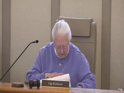
Several commissioners objected to the list of permitted recreational and horticultural uses in the major floodplain. "I don't want nurseries and stuff like that in there," said Chair Robinson, expressing concern that some permitted activities could introduce nutrient or chemical runoff into sensitive waterways. Robinson pressed staff to split the town's open-space designation from the floodplain designation and to limit intensive uses that would burden the creek and its riparian buffer.
Staff responded that permitted uses in the major floodplain are framed with safeguards: the preamble to that section requires that permitted activities "do not require structures, fill that increases developable land, or storage of materials and equipment." Staff noted the town will consult federal and state model ordinances and agencies such as FEMA, the Virginia Department of Environmental Quality (DEQ) and the Department of Conservation and Recreation (DCR) when finalizing standards. "No habitable structures will be in the floodplain on a Creston," staff said when explaining recent local applications.
Commissioners asked staff to return with a tighter, more locally tailored list of what recreational or agricultural activities should be allowed in the floodplain and to explicitly cross-reference floodplain engineering standards that will live in the Design and Construction Standards Manual (DCSM) or town code. Staff said they will reconcile technical standards between the zoning ordinance, DCSM and town code and include cross-references so users can find all applicable rules in one place.
Community amenities and open-space rules drew detailed questions about definitions and metrics. Commissioners asked staff to confirm which landscape elements count as "usable open space" and to remove features such as parking-island turf and narrow sidewalk strips from the open-space tally. Staff said a usable-amenity must meet characteristics in the draft (shaded planting, accessibility, integration into the development) and noted the draft already excludes parking medians and tiny sign islands from amenity calculations. Staff also pointed to an example in the Crescent Design District: in at least one amenity table a 50% canopy coverage minimum is required for certain elements.
Commissioners also asked staff to revisit two details: (1) the minimum listed amenity size, which staff said can be as little as 300 square feet (0.007 acre) in some contexts, and (2) canopy coverage requirements for public squares and plazas to ensure shading and long-term tree cover.
Use categories, limited uses and special exceptions were another central topic. The draft replaces long enumerations of discrete land-use names with broader "use categories" (agricultural, residential, public/institutional, civic, industrial, commercial, utilities and telecommunications) paired with example lists and characteristic tests. Staff described the approach as a way to reduce the number of ordinance amendments needed when new business models appear and to give the zoning administrator a clearer framework to assess unlisted uses.
Commissioners asked how the system will be applied in practice. Staff explained the process: 1) a developer checks whether a proposed activity fits a listed use (for example, "continuing care facility"); 2) if not listed explicitly, the zoning administrator can evaluate the activity against a use category’s stated characteristics and example uses; and 3) the use table (division 10) then indicates whether a use is permitted (P), permitted with standards (L), minor special exception (M) or special exception (S) in each district. For example, continuing-care facilities are shown as a special-exception use in many residential mixed districts; that means an applicant may seek a legislative review but still must meet the ordinance’s use standards and compatibility tests.
Commissioners asked staff to better document the practical steps for applicants and staff (definitions to consult, where use‑standards live, and how catch-all entries are applied) and to flag common examples that historically have required legislative review so that commonly approved uses could, where appropriate, be codified as limited uses to streamline review.
Other items and next steps: commissioners asked staff to add the noise‑abatement corridor to the draft map, to work with the Board of Architectural Review on historic-overlay language, and to return with specific edits on floodplain uses, amenity thresholds (including the 300-square-foot minimum), and canopy requirements for public squares. Staff also reminded the commission that the public comment period on the draft zoning text remains open and that the project web page contains the draft and materials for public review.
Votes at a glance
- Motion to adopt the meeting agenda as submitted — moved (unnamed), second (unnamed); outcome: approved (ayes recorded from Chair Robinson, Commissioner Jennifer, Commissioner Candace). The motion to adopt the agenda appeared near the start of the meeting.
- Motion to approve the minutes of the April 3, 2025 meeting — moved (unnamed), second (unnamed); outcome: approved (ayes recorded from Chair Robinson, Commissioner Jennifer, Commissioner Candace).
What staff will return with: staff said it will (a) refine the floodplain permitted-use list and add clearer cross-references to the DCSM and town code; (b) revisit amenity minimums and canopy requirements for plazas and squares; (c) add the noise-abatement corridor to the zoning map; and (d) prepare clearer guidance on use-category application and on which uses might be safely shifted from special-exception to limited-use status to reduce review burden for routine proposals.
Meeting context: commissioners said the rewrite is a significant reorganization but that the use-category approach offers potential efficiencies if the commission and staff tighten language and clearly document how to apply standards and where technical engineering requirements will live. The commission scheduled follow-up work sessions and asked commissioners to review the use tables and supporting standards before the next meeting.