Get Full Government Meeting Transcripts, Videos, & Alerts Forever!
Get email alerts on the Tactical Urbanism topic
No spam. Unsubscribe anytime.
Carbondale commission advances tactical urbanism recommendations, directs traffic counts
Summary
CARBONDALE — The Carbondale Bike & Trail Commission approved its prior meeting minutes and directed staff to collect traffic counts after reviewing subcommittee recommendations to pilot tactical urbanism and low-cost traffic-calming measures on West Main, Hendrick, Sopris and other corridors.
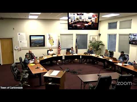
CARBONDALE — The Carbondale Bike & Trail Commission on an April virtual meeting approved its prior meeting minutes and spent the bulk of the session reviewing a set of tactical urbanism and low-cost traffic-calming recommendations intended for near-term testing and later referral to the town trustees.
Commission members and residents described a two-track approach: a focused set of pilot measures concentrated on a few streets to test layered techniques (striping, temporary bollards, painted bulb-outs) and a broader set of inexpensive, townwide actions (repainting crosswalks, sharrows, wayfinding) to shift how people perceive and use streets.
The subcommittee that walked Hendrick and West Main recommended bike lanes on West Main and Hendrick, and proposed linking those lanes to Sopris and then to downtown. The group also recommended testing raised crosswalks or temporary raised-feel markings, corner bulb-outs and painted intersections, and short sections of parking removal on Sopris to accommodate two-sided bike lanes while retaining parking on at least one side.
"Our first recommendation is is bike lanes at West Main and at Hendrick and and then linking over to Sopris," said Rick, a commission member who presented the walking group's findings. The commission heard residents' reports from the walk: an 11-person turnout, including local neighbors, who described Hendrick as a wide street with little regular parking but periodic event parking by Miners Park. Members said the width makes it prone to fast driving and that narrowing treatments could have both safety and speed-reduction benefits.
Staff member Kevin told the commission staff will begin collecting traffic data next week to measure volumes and speeds at locations residents identified. "We're gonna start doing that next week," Kevin said. Commissioners agreed that the counts should inform where and how to apply treatments and what to bring forward to trustees.
Commissioners and staff discussed implementation details and constraints. Kevin flagged coordination needs with the Colorado Department of Transportation and technical rules in the Manual on Uniform Traffic Control Devices (MUTCD) for signalized intersections and pavement markings, and noted winter snow-plow compatibility as a factor for some fixture choices. He also described options for temporary versus semi-permanent installations: "If we have bike lanes striped out there, we probably would use the temporary bollards as well... once we get close to snow season, probably remove those bollards, but leave the striping there."
The commission discussed several specific locations and treatments that emerged from the walk and a separate low-cost-safety meeting: - Hendrick (near Miners Park): bike lanes, a traffic-calming element near Barber, testing painted medians or a split median in lieu of a full circle, and coordination with the Parks & Recreation Commission about eliminating parking adjacent to the park. - West Main: bike lanes and visible entrance treatments; discussion that new higher-density housing on the north side might warrant a 20 mph zone or traffic-calming treatments. - Sopris (Fourth–Eighth): possible removal of parking on one side to allow bike lanes on both sides; bulb-outs and full crosswalks at the Sopris–Eighth reconfigured intersection. - Eighth Street: a candidate for a different typology of test — narrow, tree-lined, with existing on‑street parking and frequent block-to-block stops — to trial paint-based or painted-edge treatments. - Main & Second: a possible planted median or small center diversion to slow approaching traffic; caution was raised because similar installations have been struck by vehicles in the past. - Rio Grande Trail / Village Road / 133 interchange: better wayfinding, a clearer pedestrian/bicycle path through the bus stop area, and discussion of a bike box or green pavement at the Village/133 signal, noting CDOT owns and controls the signalized intersection.
Commissioners and staff discussed specific materials and devices for temporary pilots: painted bulb-outs, green bike boxes or green-backed sharrow markings, temporary bollards, low-profile rubber curb treatments, and snow‑plow compatible recessed pavement markers. Kevin said some pavement markers are plowable but can be costly; the MUTCD and the presence of traffic loops or video detection at signals may affect design choices for bike boxes.
Members emphasized layering treatments in one area rather than dispersing single tactics townwide so the combined effect can be measured: bike lane striping plus vertical separation, visual art or painted crosswalks, and temporary planters or bollards. Several commissioners recommended a public outreach plan — suggested name "Carbondale Cares" — to inform residents about pilots and gather neighborhood input before installations. Staff and the subcommittees agreed to prepare a tighter set of recommended locations and designs, collect traffic data, and meet with Kevin to test feasibility and prepare materials for trustees.
The commission also noted dependencies and follow-up items: a planned East Atlantic Crossing project and its detour patterns may affect traffic at Shorty Pabst and therefore influence timing or design near that intersection; consultation with Park & Rec for park-adjacent parking changes; and coordination with CDOT for treatments affecting Highway 133 approaches.
Votes at a glance - Approval of minutes from last meeting — motion by Ali and Ally; seconded by Rick; outcome: approved (all in favor, no roll-call tally recorded).
Next steps described by commissioners: staff will begin targeted traffic counts at resident-identified sites; subcommittees will refine specific recommendations (materials, exact curb geometry, and community outreach language); and the commission will present a consolidated package to the trustees once team and staff technical checks are complete.
The commission meeting continued after the discussion on tactical urbanism; members agreed to maintain the subcommittees, refine recommendations over the next month, and assemble a PR/outreach work group to prepare public-facing messaging before pilots are installed.