Get Full Government Meeting Transcripts, Videos, & Alerts Forever!
Get email alerts on the Land Use Development topic
No spam. Unsubscribe anytime.
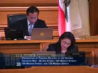
Board rejects appeals and clears subdivision maps for Mexican Museum / 706 Mission Street project
Summary
After consolidated hearings, the Board of Supervisors approved tentative and vesting subdivision maps needed to convey the Jesse Square garage and develop the Mexican Museum and an adjacent tower, rejecting appellants' challenges to the EIR and project entitlements.
The San Francisco Board of Supervisors consolidated appeals concerning tentative subdivision maps for parcels tied to the Mexican Museum and the proposed 43‑story residential tower at 706 Mission Street and voted to approve the maps necessary to move the project forward.
The consolidated hearing considered two related mapping applications: a four‑lot airspace parcel map for 738 Mission Street (needed to convey the Jesse Square Garage and related parcels) and a five‑lot airspace vesting tentative map subdividing a larger assemblage that includes the proposed tower and museum parcels. Appellants argued earlier environmental and design approvals are deficient and said new economic information presented after certification of the EIR required supplemental environmental review.
Planning and public‑works staff summarized the subdivision maps and explained that the Planning Commission and Historic Preservation Commission previously considered the project's entitlements, findings and design approvals. Planning staff said the EIR was certified and appeals to it were heard and rejected previously by the board; staff said no new information has been provided that would alter conclusions in the certified EIR and that the map approvals conform to prior entitlements, the general plan and CEQA findings.
Appellant counsel Tom Lippe argued the vesting map grants development rights and that new economic analyses submitted by the project sponsor after the board certified the EIR could require a subsequent or supplemental EIR on shadow impacts and project height. Lippe said an independent feasibility analysis supported a lower tower height that would reduce shadow impacts.
City staff and the project sponsor told the board they had addressed historic preservation, shadow and other issues during prior hearings and that the mapping was a necessary, technical step to convey property interests to the project sponsor. The project sponsor's representative said the design and mitigation measures were worked out with the planning department and that parking was intentionally excluded on site to preserve ground‑floor retail.
Supervisor Kim moved to approve the Department of Public Works decision to approve the tentative map (item 24) and to table related motions to disapprove; the motion passed on roll call with 11 ayes. On the related vesting tentative map (item 28), the board also voted to approve the department decision and table the disapproval motions.
Why it matters: Approval of the subdivision maps enables property conveyances and recordation steps that clear the way for project financing and construction schedules tied to the museum and the residential development.
What’s next: With the maps approved, project sponsors may proceed with conveyances and final approvals required for construction. Appellants retain other legal avenues outside the board where allowed by court rules.