Get Full Government Meeting Transcripts, Videos, & Alerts Forever!
County staff present restrictive‑covenant mapping and plan June 17 "fill‑and‑file" event
Summary
Dane County planners briefed the Zoning and Land Regulation Committee on a project mapping historic restrictive covenants across roughly 4,000 parcels and described a planned June 17 public "fill‑and‑file" event to allow residents to record a form identifying discriminatory covenants in the land record.
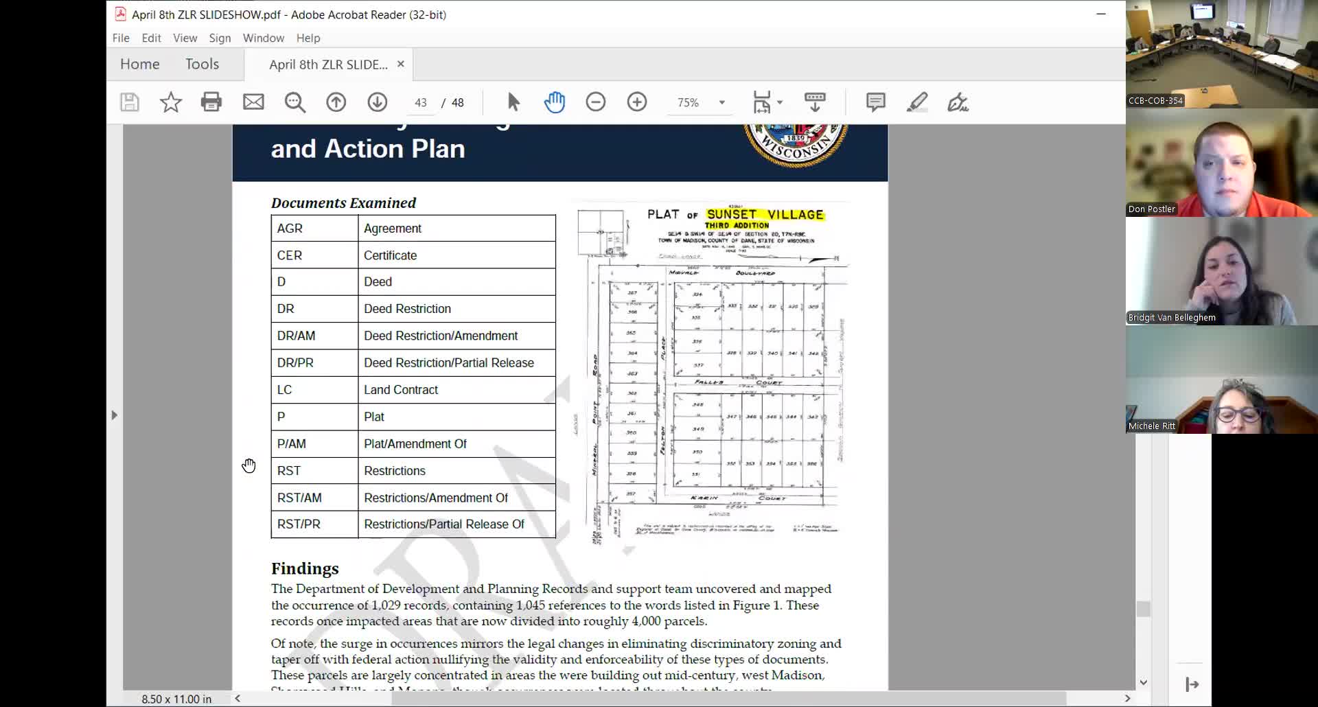
Senior planner Bridget Van Bellegham updated the committee on the county’s Prejudice in Places project, which has identified roughly 4,000 parcels with restrictive covenants or historic plat language that may include racially restrictive wording. The project team has processed and mapped those records and prepared a white paper summarizing methods and preliminary findings.
Van Bellegham said the greatest concentrations of affected parcels are in Madison (especially the west side), Shorewood Hills,…
Already have an account? Log in
Subscribe to keep reading
Unlock the rest of this article — and every article on Citizen Portal.
- Unlimited articles
- AI-powered breakdowns of topics, speakers, decisions, and budgets
- Instant alerts when your location has a new meeting
- Follow topics and more locations
- 1,000 AI Insights / month, plus AI Chat