Get Full Government Meeting Transcripts, Videos, & Alerts Forever!
Oro Valley staff seek to correct land-use map mismatches at four sites
Summary
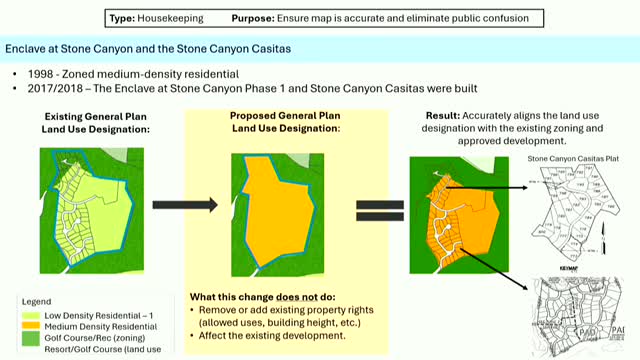
Planning staff proposed 'housekeeping' changes to Oro Valley's 10-year land-use map at four sites to align the map with existing zoning and built development; working group generally supported the corrections and staff said changes will proceed through the public review process.
Oro Valley planning staff told a resident working group they will propose a set of "housekeeping" changes to the town's 10-year land-use map so the map matches existing zoning and development at four sites.
The proposed corrections focus on Stone Canyon (Enclave at Stone Canyon and Stone Canyon Casitas), the former Rancho Vistoso clubhouse area now in the Vistoso Trails Preserve, the Miller Ranch area (northwest corner of La Cañada and Tangerine by Lehman Academy), and a corner property at Lambert and La Cholla. Planning staff said the adjustments are intended to reduce public confusion where the land-use designation on the general plan does not match the zoning or what has already been built.
Melanie, a planning staff member, summarized the distinction between the…
Already have an account? Log in
Subscribe to keep reading
Unlock the rest of this article — and every article on Citizen Portal.
- Unlimited articles
- AI-powered breakdowns of topics, speakers, decisions, and budgets
- Instant alerts when your location has a new meeting
- Follow topics and more locations
- 1,000 AI Insights / month, plus AI Chat