Get Full Government Meeting Transcripts, Videos, & Alerts Forever!
Get email alerts on the Flooding Stormwater topic
No spam. Unsubscribe anytime.
San Benito backs regional RGV flood-control district after stormwater presentation; experts warn forecasting needs more funding
Summary
San Benito commissioners voted 3-2 to support a regional Rio Grande Valley flood-control district after a presentation on a regional sensor network and public comments from flood victims. Presenters said the current sensor network produces retrospective data and that deploying continuous forecasting will require additional funding and computing.
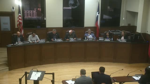
San Benito commissioners voted 3-2 on April 15, 2025, to approve a resolution supporting creation of a regional Rio Grande Valley (RGV) flood-control district, an action proponents say is a first step toward coordinated, watershed-based flood management across Cameron, Hidalgo and Willacy counties.
The vote followed a presentation by representatives of the regional stormwater task force and the group that operates a sensor network across the valley, who described a 61-station monitoring system that includes three sensors funded and sited inside San Benito. Presenters and several residents who described repeated home flooding urged the commission to support a single regional entity to prioritize projects by watershed rather than by political boundaries.
The stormwater task force presentation matters because it tied recent, severe flooding to gaps in forecasting and management and mapped an approach to give officials and residents earlier, more actionable warnings. Proponents said the combination of sensor data, hydrologic models and additional funding could enable the valley to move from post‑event analysis to multi‑hour forecasting and targeted mitigation.
Dr. Andrew Ernest, a representative of the regional stormwater task force, told the commission the sensor network and modeling work represent “the culmination of this” regional effort and described a system built over several years to produce stage‑height data used to model inundation. Ivan Santos, a research engineer for the task force, gave technical details: the field stations include a solar pole, cable to the channel and in‑water staff gauges and sensors that record stage heights in real time. Santos said the network spans 61 stations across the valley and that San Benito paid to install three local sites near Williams Road/expressway, Jost Road and Audrey Lane, and Trevecca Street.
Santos described how engineers combined the observed stage data with digital elevation models and ran HEC‑RAS (a US Army Corps of Engineers hydraulic modeling program) to produce animations of water inundation for the March 26–28 event, which he said produced stage readings normally under 2 feet that spiked to about 12 feet during the storm. "We produce data, but if numbers say nothing unless you do something about with them," Santos said, explaining the modeling and the next step: forecasting.
Task force representatives said the sensor installations and the hindcast modeling were funded in part by a roughly $8.8 million award managed through the Texas Water Development Board (TWDB) and that about $20 million in additional state funding is pending to expand forecasting capacity. They cautioned the commission that the system currently provides retrospective analysis and near‑real‑time charts but not continuously running forecasts. Dr. Ernest said converting charts into continuous, operational forecasts requires sustained funding and substantial computational power; he said a forward‑looking forecasting capability is on the group’s work plan but depends on securing that funding.
Residents and advocates used the presentation to press elected officials for broader action. JV Garcia, a civil engineer and member of the Rio Grande Valley Coalition of Drainage Advocates (COTA), told the commission: “Flooding is not just a problem for San Benito or Cameron County or any of the entities; this is a regional problem that requires a regional solution.” Several residents described repeated flooding in low‑lying subdivisions and asked the city to seek engineering assessments and mitigation funding.
Supporters of the resolution said a regional flood‑control district could consolidate existing drainage districts, extend coverage to areas currently outside any drainage district and prioritize projects by watershed. Assad Salvara, a former city commissioner and member of the advocacy coalition, said the district would enable a single entity to seek legislative funding, levy taxes where authorized and manage projects across municipal and county borders.
Opponents or cautious commissioners expressed concerns about where authority and money would reside, and whether a new regional entity might duplicate or displace existing drainage districts. The resolution as adopted asks the city to support formation of a Rio Grande Valley flood control district as described in a petition from the RGV Coalition of Drainage Advocates; it does not obligate the city to provide funding or transfer authority.
Mayor Paul Tim Galvan made the motion to approve the resolution, which Mayor Pro Tem Alban seconded; Commissioner Deborah Morales seconded the motion to approve. The resolution passed on a 3‑to‑2 vote.
City officials said they will host or coordinate a public forum in the coming weeks with state legislative staff to discuss regional coordination and funding; commissioners and task‑force members indicated continued outreach to Senator Ademina Hossa and state representatives to seek legislation and the pending TWDB funds.
For now, the task force’s network provides San Benito and other cities with real‑time stage data and post‑event inundation modeling that can support future mitigation planning and grant requests. Task‑force staff advised that turning the system into an operational forecasting and automated alerting service will require additional funds, recurring operating budgets to maintain the stations and high‑performance computing resources.