Get Full Government Meeting Transcripts, Videos, & Alerts Forever!
Get email alerts on the Affordable Housing topic
No spam. Unsubscribe anytime.
Teton County reviews Northern South Park Area 1 master site plan; staff recommends approval with conditions, no vote taken
Summary
Planning staff and the applicant presented a master site plan for Northern South Park Area 1 that would allow up to 508–600 units (about 420 deed‑restricted). Staff recommended approval with six conditions; commissioners heard public comment and questions but did not take a final vote.
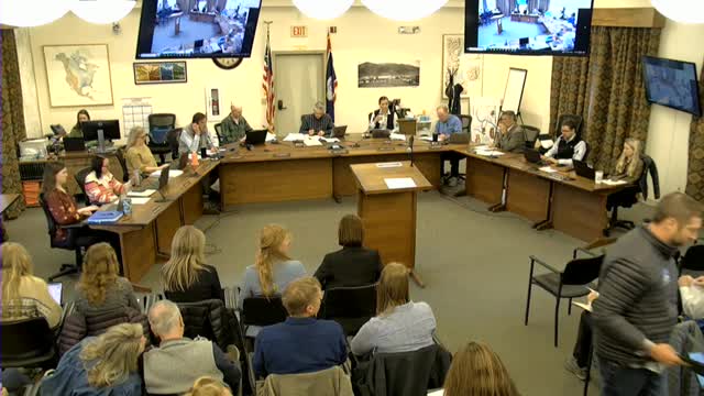
Teton County planning staff and the applicant presented the Northern South Park (NSP) Area 1 master site plan during the April 8 meeting of the Teton County Board of County Commissioners; the board heard staff analysis, design and traffic reports, and more than two hours of public comment before taking no final action.
The proposal covers roughly 74.13 acres within the 101‑acre NSP Area 1 designation and would implement the county'adopted Northern South Park incentive overlay. The applicant's materials show a potential range of 508 to 600 residential units across Area 1, of which the overlay requires 70% deed‑restricted workforce housing (at least 240 units must be affordable under the overlay). Chandler Windham, Teton County planning staff, said the application demonstrates the required plan elements and recommended approval "as conditioned," including six specific conditions for the Board to adopt at a later decision point.
Why it matters: County staff and the applicant contend the master site plan implements the NSP neighborhood plan and the county's land development regulations (LDRs) while providing a sizeable supply of deed‑restricted housing. Opponents and some county advisory boards emphasized unresolved transportation, park configuration, and wildlife permeability questions; those concerns shaped public comment and commissioners' requests for more detail.
Planning staff's presentation focused on required LDR elements: block and street layout, a capital improvements element showing sewer and domestic water connections to the Town of Jackson, a traffic impact study and transportation demand management (TDM) plan, phasing and a housing element showing the proposed deed‑restriction ratio, and park and school exaction concepts. Windham told the board the capital improvements element proposes on‑site retention for stormwater, conceptual water and sewer connections to Jackson, and a geotechnical suitability memo stamped by a Wyoming professional engineer. She said the applicant provided a transportation study and that staff relied on the West Jackson Transportation Study in evaluating off‑site mitigation needs.
Sarin Saakyan of Evolve EA, the applicant's designer, said the master plan is the product of an iterative design process with input from nonprofit housing partners and tested block‑level building typologies from local projects. "Our goal," she said, "was to implement the site standards and analyze opportunities to maximize the number of units and understand what that density might actually look like or feel like in the future." Jacqueline Kenore, the traffic consultant for the applicant, summarized the transportation analysis and said the West Jackson study and the applicant's traffic report show the corridor currently performs well except for school bell periods. Kenore said the full buildout of Area 1 would not, by itself, trigger the major off‑site improvements identified in the West Jackson study and that their traffic analysis was conservative because it did not credit TDM measures.
The applicant also presented an alternative parks plan during the meeting that enlarges a northern park to about five acres and adds a three‑acre park close to the proposed school exaction; applicants said that change would reduce total development area and could lower the total number of units by roughly 25 units (about 18 deed‑restricted units), based on their estimate.
Housing and phasing: Planning staff explained the NSP overlay allows up to 600 units in Area 1 (the master plan shows a 508–600 range) and requires that 70% of units be deed restricted; 40% of the total must be affordable. Staff described the land conveyance method proposed by the applicant (convey restricted blocks to nonprofit developers) and summarized the overlay's backstop: after 90 unrestricted units receive development plan approval, no additional unrestricted development plans can proceed until building permits for 20% of that number of restricted units have been issued.
Parks, open space and wildlife permeability were major topics. The applicant's plan initially showed nine park or pathway areas, several of which Parks and Recreation staff called too narrow to function as neighborhood parks. Parks staff asked for at least one contiguous 3.5‑acre community park and for reduced pathway acreage to be relocated into consolidated park sites; their March 28 letter (submitted to the board) requested a 3–5 acre park in addition to a 5–10 acre park. Planning staff and the applicant discussed wildlife permeability and noted consultation with Wyoming Game and Fish; staff recommended a condition requiring future development plans to demonstrate wildlife permeability along eastern and southern boundaries and through unfenced backyard continuity.
Transportation: Staff'recommended Condition 1 would require the applicant, prior to the first development plan submittal, to collaborate with county public works and the county engineer to produce a written, block‑by‑block list of contributions toward off‑site transportation improvements identified in the West Jackson Transportation Study. The list should identify responsible entities, construction impacts, benchmarks, and monitoring. The plan also includes an easement for an East‑West connector segment within Area 1; staff recommended the applicant provide the legal description of that easement prior to master site plan recordation.
Public comment and nonprofit partners: More than 30 speakers made public remarks during the afternoon session and early evening sign‑up. Teton Habitat and the Jackson Hole Community Housing Trust presented as nonprofit partners: Chris Greenville, executive director of Habitat for Humanity of the Greater Teton Area, and Anne Cresswell, executive director of the Jackson Hole Community Housing Trust, urged approval and described organizational capacity, fundraising commitments and experience building deed‑restricted housing in Teton County. Greenville said a $15 million matching challenge from the Hughes Charitable Foundation has already leveraged additional funds; Cresswell described the Housing Trust's existing record of building and acquiring affordable homes and warned that revisiting previously approved LDR provisions would jeopardize financing and schedules.
Opposition and concerns: Speakers representing the Jackson Hole Conservation Alliance, Parks and Recreation Advisory Board, and many residents stressed three recurring issues: (1) park configuration and the need for at least one larger rectangular community park to support active recreation and school adjacency; (2) wildlife permeability across the site and limits on fencing to reduce wildlife‑human conflict; and (3) potential traffic impacts on High School Road and school entrances, and whether an East‑West connector should be built earlier or in a different alignment. Several Parks and Recreation board members and staff said they were surprised not to have been consulted earlier on park layout and requested collaboration to produce functional neighborhood parks.
Outcome and next steps: Planning staff and the Planning Commission recommended approval with six conditions, including: (1) development of a structured list of block‑level contributions for off‑site transportation mitigation approved by the county engineer prior to the first development plan; (2) provision of an East‑West connector right‑of‑way easement and legal description prior to recordation; (3) future blocks demonstrating compliance with internal block face standards; (4) revision of the concept parks plan to ensure each park meets a minimum one‑acre size with relocation of certain pathway acreages to larger parks; (5) removal of any "not binding" language in the recorded master site plan copy; and (6) demonstration in future development plans of wildlife permeability on the eastern and southern boundaries through passive parks and design details such as unfenced backyard continuity. The board did not vote on the master site plan on April 8; commissioners asked questions, accepted the public comment record and scheduled continued consideration at subsequent meetings. The applicant said it will update exhibits and can incorporate alternative park layouts if directed.
Speakers quoted in this report spoke as identified in the meeting record. All references to LDR sections and neighborhood plan language reflect the wording used in staff presentations and the applicant's application materials.