Get Full Government Meeting Transcripts, Videos, & Alerts Forever!
Ivins fire chief presents citywide wildfire-risk map; council discusses insurance, fuels work and homeowner outreach
Summary
Ivins Fire Chief presented a living wildfire-risk map identifying high-, medium- and low-risk areas, and council members pressed for outreach to the state over a classification that is raising homeowners' insurance rates; chief described ongoing fuels mitigation, mosquito-abatement work and staffing gains.
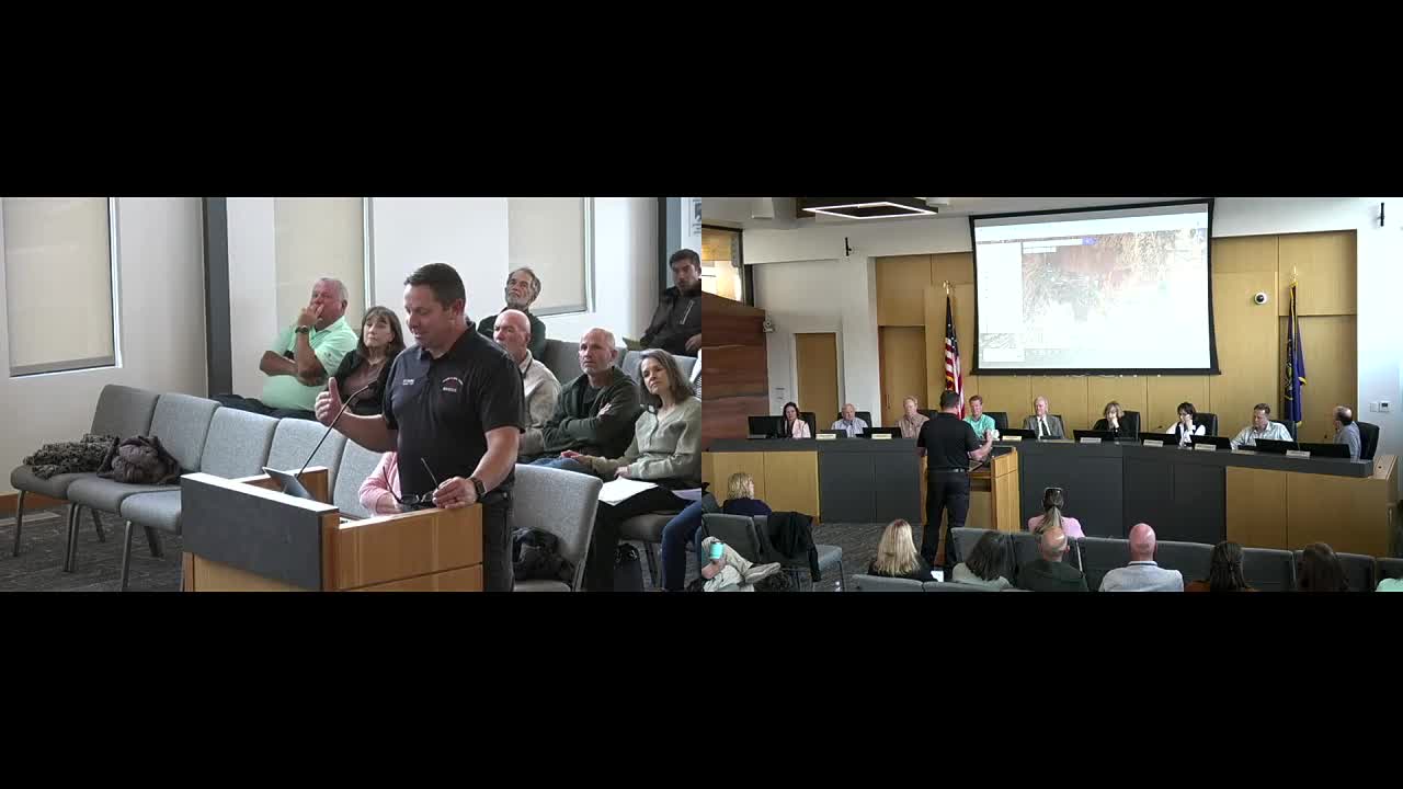
Chief Kazara told the Ivins City Council on April 3 that staff have developed a geographic, color‑coded wildfire-risk map that ranks washes, native vegetation and developed areas as high, medium or low risk and that the map will be a living document updated as mitigation work continues. "What we're trying to do is identify the heavy fuel loads and the high risk," the chief said, explaining the assessment weights fuel load, access, water availability and nearby infrastructure.
The map highlights pockets the fire department currently rates as high risk — including areas around the Cayenta neighborhood and parts of the Santa Clara River corridor where homes and infrastructure are close to native vegetation. Kazara said other areas such as the Tuohcon Wash have been downgraded to low risk after recent clearing by ACE crews, but he warned they could return to high risk without sustained maintenance.
The discussion shifted to insurance after several council…
Already have an account? Log in
Subscribe to keep reading
Unlock the rest of this article — and every article on Citizen Portal.
- Unlimited articles
- AI-powered breakdowns of topics, speakers, decisions, and budgets
- Instant alerts when your location has a new meeting
- Follow topics and more locations
- 1,000 AI Insights / month, plus AI Chat