Get Full Government Meeting Transcripts, Videos, & Alerts Forever!
Get email alerts on the Alert Warning Maps Access topic
No spam. Unsubscribe anytime.
Laguna Beach outlines five alert systems, map fixes and neighborhood access measures at town hall
Summary
Emergency managers described five redundant alert systems including a 23-siren outdoor network and encouraged registration for Nixle and AlertOC; residents raised errors on evacuation maps, narrow streets and parking restrictions for red-flag days.
City emergency staff told residents they use multiple, redundant systems to reach people during an incident and urged residents to register for alerts, while residents asked staff to correct mapping errors and to pursue neighborhood parking restrictions and Firewise programs.
Emergency operations coordinator Sarah Limonas described five alert-and-warning channels the city uses: (1) Nixle text alerts, (2) Alert OC (county-managed) registrations for multiple addresses, (3) Wireless Emergency Alerts pushed to phones, (4) the Emergency Alert System (TV/radio), and (5) an outdoor warning system. Limonas said the outdoor system includes 23 sirens that can broadcast recorded voice instructions and that redundancy is deliberate because cell and power outages can occur.
“Redundancy and variety is incredibly important when it comes to alert and warning systems,” Limonas said, and she encouraged residents to register for Nixle (text the city ZIP, 92651, to 888777) and Alert OC so they receive location-specific notices.
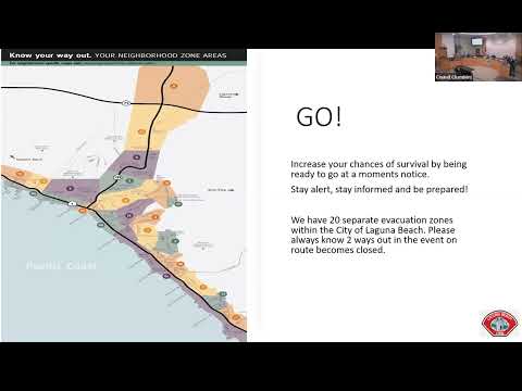
During the public question-and-answer period, several residents and community volunteers raised specific operational concerns. Penelope Milne, president of the Canyon Alliance of Neighborhoods Defense Organization (CANDU), pointed out what she described as an error on the evacuation maps that lists Aliso and Woods Canyon Wilderness Park as abutting North Laguna; Milne said that park is miles away from the area shown and that such errors can confuse residents during an emergency.
Other public commenters and volunteers urged the city to examine and expand parking restrictions in access-impaired neighborhoods such as Diamond Crestview, Bluebird Canyon and Canyon Acres; volunteers with CERT and neighborhood groups also asked the city to promote Firewise neighborhood programs to improve clearance and reduce insurance risks. Volunteer Sonny Myers described local CERT training and asked the city to expand parking restrictions for red-flag days. City officials said the wildfire mitigation ad hoc committee and staff are examining access-impaired streets and parking rules.
Speakers also discussed communications redundancies if power is shut off. Officials acknowledged public-safety power shutoffs by utilities such as Southern California Edison and said the outdoor siren system has battery backup and satellite links in some configurations; when technology fails, city staff said, first responders will revert to door-to-door notifications and vehicle loudspeakers. Officials also noted a reverse-911 capability for landlines as an additional redundancy.
City staff accepted several items of public feedback as near-term work: updating evacuation-zone names and correcting map errors, conducting a gap analysis of outdoor warning coverage, and considering a regular public test of the outdoor sirens so residents recognize their sound. City leaders said the wildfire mitigation and fire safety subcommittee will consolidate community input and return recommendations to City Council on May 6.
The town hall highlighted both the technical alert capabilities the city has in place and practical limitations—narrow streets, parked vehicles and intermittent cell service—that can complicate evacuation and response. Officials urged residents, businesses and organizations that serve children or vulnerable adults to develop redundant communication plans and practice evacuation steps ahead of high-risk days.