Get Full Government Meeting Transcripts, Videos, & Alerts Forever!
Get email alerts on the Land Use Development topic
No spam. Unsubscribe anytime.
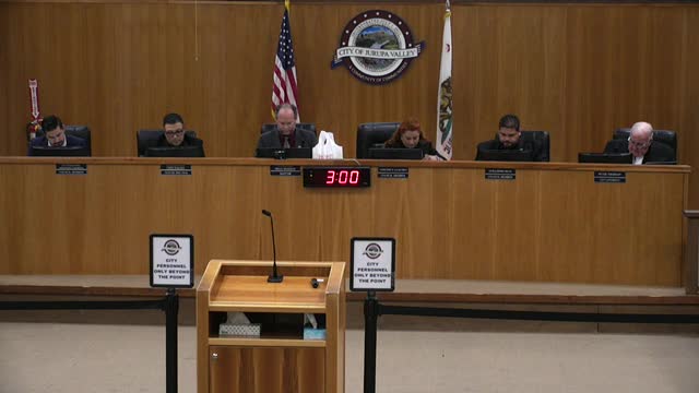
Jurupa Valley holds study session on Granite Hill proposal for 130 single‑family homes; council flags RHNA and SB 330 upzoning obligations
Summary
City staff and the developer presented a study‑session overview of the Granite Hill project, a proposed 130‑lot subdivision on 21.87 acres. Council members raised concerns about state no‑net‑loss rules (SB 330), RHNA accounting, fire‑hazard insurance limits for higher‑density housing and the developer’s suggested upzoning sites.
City of Jurupa Valley staff and the project applicant presented a study‑session overview Thursday of a proposed residential subdivision on 21.87 acres north of Granite Hill Drive that would create 130 single‑family detached homes.
The project team described the current application as Master Application 24033 (GPA 24001; Tentative Tract Map 38972; Change of Zone 24001; Site Development Plan 24018) for a site north of State Route 60 between Quartz Canyon Road and Pyrite Street. City planner Rob Gonzales told the council the project as presented is a study session only and staff is asking for comment to guide the developer’s next steps; no formal council action was requested or taken.
Why it matters: the site’s adopted general‑plan designation was set to “Highest Density Residential” (HHDR) during the 2024 housing element update, which requires 20–25 dwelling units per acre. The applicant proposes a redesign that would lower the site’s density to about 5.94 dwellings per acre, prompting the city and applicant to address state requirements intended to prevent “no net loss” of housing capacity and RHNA accounting as well as SB 330 (the Housing Crisis Act of 2019) upzoning timelines.
Project details and entitlements Rob Gonzales said the parcel is composed of six assessor parcels and the applicant, identified in the presentation materials as Riverside Legacy 4 LLC with project representation by EPD Solutions, proposes 130 two‑story, three‑bedroom, 2.5‑bath homes with two‑car garages and floor plans described in the staff presentation as roughly 1,300–1,500 square feet (planner gave a range of floor plans). The application package would require a general‑plan amendment (GPA) to change the site’s designation from HHDR to Medium High Density Residential (MHDR), a change of zone from R‑3 (General Residential) to Planned Unit Development (PUD), a tentative tract map and a site‑development permit to approve conceptual site, landscape and architectural plans.
Gonzales and the applicant displayed the project’s third iteration site plan, which now proposes all single‑family detached homes (earlier submittals had mixed multifamily/townhome product). The current plan also shows about 39,000 square feet of common open space and a central recreational area with seating, a turf play area, bike parking, a dog run and smaller neighborhood pocket parks and trails along the site frontage.
RHNA, SB 330 and no‑net‑loss concerns Staff and the applicant emphasized two state‑level constraints that shape the project path. First, RHNA (Regional Housing Needs Allocation) accounting requires the city to demonstrate capacity by income category; Gonzales said the proposal would shift credits among income categories and that staff is analyzing how the 130 market‑rate units proposed would be credited for RHNA purposes.
Second, SB 330 contains no‑net‑loss provisions that require jurisdictions to accommodate replacement capacity when a local action reduces zoning capacity. Gonzales told the council the city would likely need to identify concurrent upzoning elsewhere to replace the lost capacity; the applicant provided three candidate sites (labeled A, B and C in the presentation) the applicant suggests could be upzoned to make up the capacity the project would remove. The planner emphasized SB 330 imposes timelines for concurrent upzoning and that, if the city approves a lower density without replacing capacity, the city could face compliance problems under state law.
Applicant and conservation context The presenter for the applicant said the property owner is Ecosystem Investment Partners (EIP), a company that combines restoration and mitigation‑banking work with development on different parcels it owns. The applicant representative said EIP has dedicated roughly 25.6 acres elsewhere to the Riverside County agency referenced in the presentation (identified in the slide materials as RCA) for conservation to satisfy MSHCP‑related goals and retained the roughly 21 acres nearest the roadway for potential development. The applicant representative said the dedication of the other acreage is already complete and that the 21.87 acres under consideration have topographic constraints (about 100 feet of elevation change), rock outcroppings and existing debris basins that reduce net developable area.
Council concerns and direction Multiple council members expressed concern about the project’s effect on Jurupa Valley’s RHNA inventory and the difficulty of finding and securing upzoning options to offset the loss of capacity. Council members asked staff to confirm that the three off‑site parcels suggested by the applicant are not owned by the applicant (staff confirmed the city had not been told that the applicant owns those sites) and cautioned that upzoning private parcels without owner consent would be a difficult and potentially contentious path.
Fire hazard and insurance issues were raised repeatedly. The applicant’s representative said the site is in a high fire hazard area and that builders had declined to proceed with the earlier higher‑density townhome approach because insurance and underwriting concerns made multifamily development unworkable; several council members noted the state is about to reissue final fire‑hazard maps that could expand high‑fire areas and further affect insurability for higher‑density products.
The council’s guidance to staff (nonbinding direction, not a final decision) included requests for additional analysis of: the SB 330 concurrent‑upzoning timeline; detailed RHNA accounting by income band for the proposed change; the environmental review approach (staff said the project will require an Environmental Impact Report and the council will see a contract for that work on the April 3 consent calendar); and alternatives to preserve housing capacity while responding to site constraints and fire safety requirements.
Planning process next steps Planner Rob Gonzales told the council the applicant is preparing to begin environmental work and that a contract authorization to start the EIR consultant work was scheduled as a consent‑calendar item for the April 3 council meeting. Gonzales also said the proposal will be heard first by the Planning Commission, then come back to city council for any required approvals.
What was not decided This meeting was a study session; the council did not vote on the project, the GPA or any zoning changes. Council members emphasized they were not inclined to grant a down‑zoning that reduced Jurupa Valley’s RHNA capacity without a clear, concurrent solution for replacing the lost units.
Speakers quoted or referenced in this article are drawn from the meeting record: Rob Gonzales (city planner), the applicant representative (EPD Solutions), and council members Brian Bergson (mayor), Chris Barajas (mayor pro tem), Guillermo Silva, Veronica Sanchez and Armando Carmona.
Ending note The applicant and staff will return with additional materials: the proposed EIR authorization scheduled for the April 3 consent calendar, revised RHNA accounting and analysis of candidate upzoning sites for SB 330 compliance.