Get Full Government Meeting Transcripts, Videos, & Alerts Forever!
Lexington posts vacant‑land map and data hub to help planning and redevelopment
2716043 · March 20, 2025
AI-Generated Content: All content on this page was generated by AI to highlight key points from the meeting. For complete details and context, we recommend watching the full video. so we can fix them.
Summary
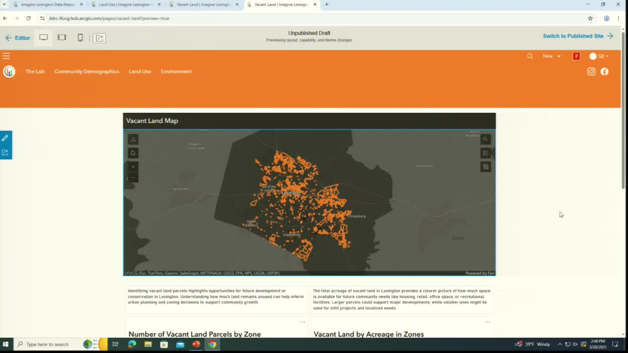
Planning staff unveiled an ImagineLexington Data Research Center layer showing vacant parcels by zone and acreage; staff said the portal will be updated annually and can be used to identify vacant B‑3 parcels and other redevelopment opportunities.
Planning staff provided an update on the ImagineLexington Data Research Center and said the portal now includes a map layer that shows vacant parcels across Lexington‑Fayette Urban County by zoning classification and acreage.
Staff said the vacant‑land layer uses a longstanding LFUCG…
Already have an account? Log in
Subscribe to keep reading
Unlock the rest of this article — and every article on Citizen Portal.
- Unlimited articles
- AI-powered breakdowns of topics, speakers, decisions, and budgets
- Instant alerts when your location has a new meeting
- Follow topics and more locations
- 1,000 AI Insights / month, plus AI Chat
30-day money-back on paid plans