Get Full Government Meeting Transcripts, Videos, & Alerts Forever!
Get email alerts on the Waterfront Resilience topic
No spam. Unsubscribe anytime.
Santa Barbara launches 30‑year waterfront adaptation plan to prepare for rising seas
Summary
City staff told the Planning Commission on March 13 that a newly launched 30‑year waterfront adaptation plan will use updated modeling, regional monitoring, and community outreach to develop implementable measures for the low‑lying waterfront from Leadbetter to the Clark Estate.
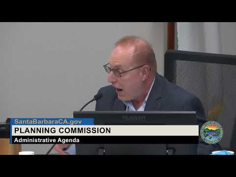
On March 13, 2025, the Santa Barbara Planning Commission received a staff briefing on a newly launched 30‑year Waterfront Adaptation Plan intended to prepare the city’s low‑lying waterfront for increased storm surges, erosion and coastal flooding.
The planning effort, presented by Melissa Hetrick and Timmy Bolton of the city’s Sustainability and Resilience program, will cover the coastline from Leadbetter Point to the Clark Estate and aims to produce near‑term, implementable strategies — including conceptual and 30% design drawings for targeted measures — to protect public access, recreation, habitat and critical infrastructure.
City staff said the project will pair updated, higher‑resolution coastal and sediment‑transport modeling with a regional shoreline monitoring program, analysis of the harbor breakwater and focused study of the harbor commercial area and West Beach. “Our vision for the 30‑year waterfront adaptation plan is to develop a practical plan that prepares the Santa Barbara Waterfront for increased storm surges, erosion, and flooding,” said Timmy Bolton, Climate Adaptation Analyst.
Why it matters: the waterfront is publicly owned and contains key city assets — beaches, Stearns Wharf, harbor facilities, a multimodal beachway and wastewater infrastructure — that staff say are already experiencing damage during storm events and will face growing risk as sea level rises.
What staff told the commission - Scope and timeline: Staff said the plan focuses on a roughly 20‑ to 30‑year near‑term horizon to preserve the widest range of adaptation options. The project team expects to complete major technical work and public outreach through 2025–2026, publish a public review draft in fall 2026, and bring a final plan to City Council in early 2027. Staff told commissioners the plan will support future coastal permitting and grant applications and will likely lead to Local Coastal Program (LCP) amendments.
- Modeling and monitoring: The project will build on statewide USGS models but fill gaps with higher‑resolution modeling and targeted sediment‑transport analysis for the harbor and West Beach. Staff emphasized development of a regional coastal adaptation monitoring program in partnership with regional entities to produce consistent, manager‑focused data.
- Measures under consideration: Staff said they will develop a range of options from traditional engineered (“gray”) approaches to nature‑based (“green”) or hybrid measures. Conceptual designs will include improvements to the multimodal beachway and targeted protection in the harbor commercial area; staff noted trade‑offs will be required because of limited space and competing uses such as parking and public access.
- Funding and partnerships: Hetrick told the commission the city has obtained more than $5 million in state grant funding for planning and pilot projects and noted additional planning grants and implementation opportunities through the Coastal Conservancy and state climate funding. Staff said the city’s status as one of the few jurisdictions with an adopted sea level rise adaptation plan strengthens its position for implementation grants and coastal permitting.
- Community engagement: Staff described a bilingual outreach program and reported roughly 800 responses to an early public sentiment survey. Outreach approaches include pop‑ups on the waterfront, open houses, digital maps and collaboration with Promotoras for Spanish‑language engagement.
Questions and concerns from the commission Commissioners asked about coordination with neighboring jurisdictions, the project’s potential effects on sediment transport, wastewater system vulnerabilities, and dependencies on federal partners. Commissioner Barnwell urged examination of creeks and groundwater recharge as part of flood mitigation. Commissioner Wisscomb asked whether the plan will require state LCP amendment — staff confirmed LCP amendment will be required for permitting of many waterfront projects — and about coordination with Goleta and regional groups. Staff said they are working regionally through a sea level rise working group and with consultants Stantec, Bionic and others on technical work.
Staff cautioned that some partnerships (NOAA, USGS) and federal funding pathways carry uncertainty and that the city is pursuing a range of state and regional grant sources to advance design and construction phases. "Public health and safety should come first," Hetrick said, describing the adaptation plan’s guiding principles.
No formal action taken The commission received the briefing and posed questions; no vote or regulatory decision occurred at the March 13 hearing.
What comes next Staff said updated modeling and a vulnerability assessment will frame a major outreach push in the fall; conceptual alternatives will follow and staff expect to seek grant funding for design and construction of targeted improvements once planning is complete. The planning commission and other boards will be asked to review major deliverables as the plan moves toward a public review draft in late 2026.