Get Full Government Meeting Transcripts, Videos, & Alerts Forever!
Get email alerts on the Land Use Variances topic
No spam. Unsubscribe anytime.
Board of Adjustment continues Prieto lot-width variance to May after survey discrepancies cited
Summary
The Maricopa County Board of Adjustment continued a variance request for a parcel near Rio Verde to its May hearing after staff and board members raised concerns about an inaccurate record of survey and the division of an original 40-acre parcel into multiple substandard lots.
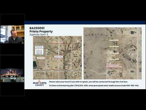
The Maricopa County Board of Adjustment on March 13 continued a variance request affecting a parcel in District 4 — BA250001, the Prieto property — to the board's May 15 hearing to allow the applicant to pursue survey corrections and consult with a neighboring owner.
The request would have established a lot area of 43,552 square feet and a lot width of 32 feet for APN 50412237 in the Rural-43 zoning district; the minimums required in Rural-43 are 43,560 square feet and 145 feet, staff said. Staff and board members emphasized that the parcel was created by a series of unregulated splits from an original roughly 40-acre parent parcel and that the current record of survey labels each resulting lot —one acre— despite the specific square footage showing each is slightly under an acre.
Nick (Maricopa County Planning & Development) told the board the five parcels created from the most recent split each measure about 132 feet in width, roughly 13 feet short of the Rural-43 minimum. He said the subject parcel is the southernmost of the five and is 8 square feet short of one acre at 43,552 square feet. Applicant Sonia Prieto confirmed she owned four of the five parcels and that the middle parcel had been sold after the split; she said she did not realize the subdivision's measurements would leave the lots nonconforming.
Board members discussed alternatives, including combining parcels to create four conforming lots or reorienting lot lines and easements. Chairman Sherman Loper encouraged the applicant to contact the surveyor and, if necessary, the Arizona Board of Technical Registration about the apparent discrepancy between the map label —one acre— and the precise square-foot figures. Member Carden said denial might persuade the middle-lot owner to negotiate a reconfiguration; Loper said he wanted to give the applicant time to pursue survey corrections and to reach out to the middle parcel owner.
Chairman Loper moved to continue BA250001 to the May 15 hearing to allow the applicant 60 days to work with staff, the middle parcel owner and the surveyor; Member Clapp seconded. The motion passed by roll-call vote 3-0.
The board recorded no formal approval or denial of the variance on March 13. The continuance preserves the applicant's ability to seek reconfiguration or corrected survey documentation before the board again considers a variance.
Details in brief: the subject parcel's recorded square footage: 43,552 sq ft (8 sq ft shy of 43,560); recorded lot width approximately 132.03 ft (about 13 ft shy of the 145 ft Rural-43 minimum). The middle of the five split parcels contains a manufactured home and is under separate ownership, which complicates remedies that would create four conforming lots without the middle parcel owner's participation.
The board's discussion and the continuance vote occurred during the public hearing portion of the March 13 meeting. The applicant advised she would pursue the leads suggested by the board and staff.
The case remains continued to the May 15, 2025 Board of Adjustment hearing; no final variance decision was made on March 13.