Army Corps launches 10-county flood-risk study, asks Owsley County for local input
Loading...
Summary
The U.S. Army Corps of Engineers has begun a federally authorized, roughly $3 million flood-risk study covering 10 counties in eastern Kentucky, including Owsley County; the Corps asked the fiscal court to provide local information, name a point of contact and send representatives to virtual stakeholder workshops.
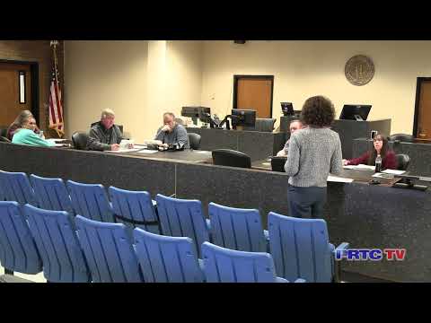
The U.S. Army Corps of Engineers on Monday told the Owsley County Fiscal Court it has begun a federally authorized flood-risk management study covering a 10‑county area in eastern Kentucky and asked the court to help identify local flooding problems and a point of contact.
Laura Mattingly, project manager with the Army Corps of Engineers in Louisville, said the study — authorized in the Water Resources Development Act of 2022 and funded at about $3,000,000 — will examine a range of options from large structural projects such as dams and levees to localized solutions such as buyouts, raising in place and floodproofing. “We are at the beginning of this study. We are still collecting data,” Mattingly said.
Mattingly said the Corps is coordinating with the Perry County Fiscal Court as an initial nonfederal signatory on the cost-share agreement and with state agencies including the Division of Water and the Department for Local Government. She said the study builds on previous and current local studies and noted the study area has seen many federally declared flooding disasters since 1967.
The Corps asked the court to: identify a local point of contact; provide representatives who can attend one or more virtual stakeholder workshops to describe “on the ground” issues such as frequently flooded locations and proposed development; and help publicize an online map and comment tool accessible via a QR code Mattingly showed. “So what we would like to do is, we’re gonna create posters or social media and demographics for you all to push out, so we can get as many…comments as possible,” Mattingly said.
Mattingly told the court the study team is aiming for a public charrette in February (likely virtual) and a later public review when a draft report is available. She warned that a study of this size typically takes more than three years to complete but said the Corps will try to move as quickly as practicable given local urgency.
On next steps if a project is recommended, Mattingly described the normal project sequence: the Corps would identify an alternative plan, then a design and construction phase would require a project partnership agreement with a nonfederal sponsor. That sponsor — typically one or more counties in the study area — would be responsible for real estate acquisition and later operations and maintenance. She said the federal/nonfederal cost share is typically 65% federal / 35% nonfederal, with “processes that exist to decrease that amount” for the nonfederal sponsor.
Members of the court raised local concerns during the Q&A, including low bridges that back up water during flood events and local stormwater and culvert problems. Mattingly said she would look into whether the study could address culvert and stormwater issues and that the Corps is collecting locations and examples of problem bridges and backups to include in its mapping.
Mattingly and the court also introduced Carlos Cameron, district director for Congressman Hal Rogers, who attended and offered the district office’s assistance.
The Corps’ initial outreach covers Owsley County and nine neighboring counties; Mattingly asked the court to provide contact names for stakeholder engagement and to encourage residents to use the Corps’ online map and comment tool.