Get Full Government Meeting Transcripts, Videos, & Alerts Forever!
Get email alerts on the Fire Safety Mapping topic
No spam. Unsubscribe anytime.
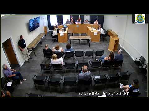
Ione council introduces ordinance adopting 2025 CAL FIRE hazard severity map for local responsibility area
Summary
At the July 1 meeting the council introduced and waived first reading by title only of Ordinance No. 535 adopting CAL FIRE’s 2025 Fire Hazard Severity Zone map for the Local Responsibility Area; staff opened a two‑week public comment period and must submit the map by July 22.
The Ione City Council introduced and waived first reading by substitution of title only of Ordinance No. 535, which would adopt the California Department of Forestry and Fire Protection (CAL FIRE) 2025 Fire Hazard Severity Zone (FHSZ) map for the city’s Local Responsibility Area (LRA).
City fire officials and the fire marshal told the council the ordinance responds to a state mandate under the Public Resources Code and the Government Code. The city must adopt the map and open a public review period; staff said the city has a two‑week public comment window and must submit results to CAL FIRE by the July 22 deadline. The map’s classification (very high, high, moderate, not mapped) is based on modeled vegetation, topography, historic fire behavior and local climate factors and is intended to inform building codes, defensible space and mitigation planning.
Why it matters: adoption of an FHSZ map affects building and defensible‑space requirements for parcels mapped in higher hazard zones; property owners commonly ask whether compliance costs — including tree removal and vegetation management — will be supported by the city or landowners.
Public comment: At the public hearing residents asked who will pay to remove trees and vegetation that may be newly required to be cleared. “I’d like to know who’s gonna pay for moving all the trees… it costs money to remove a tree,” one resident said. Staff and the fire marshal said landowners and local jurisdictions will have five years to provide input and make correction requests to the mapping; staff also said the city is upgrading weed‑abatement practices in some locations and will collect public comments during the review period.
Council action and outcome: A council member moved to introduce Ordinance No. 535 and waive the first reading by substitution of title only; the motion was seconded and the council voted in favor with no recorded dissents. Staff said a second public hearing and formal adoption are expected at the next council meeting, after the comment period concludes and before the July 22 submission deadline.
Ending: The city will post map materials and the comment process on the city website, at city hall and at the fire station. Staff emphasized the mapping is a state process and corrections or appeals occur through the multi‑year review window.