Get Full Government Meeting Transcripts, Videos, & Alerts Forever!
Get email alerts on the Route 6a Visioning topic
No spam. Unsubscribe anytime.
Cape Cod Commission outlines Route 6A visioning study, cites safety data and seeks public input
Summary
The Cape Cod Commission presented a two-year Route 6A visioning study that compiles speed, crash and pedestrian counts, highlights near-term MassDOT projects and solicited public comment on safety, sidewalks, historic character and utilities.
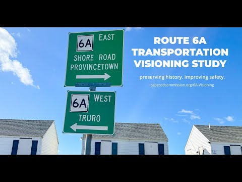
At a public meeting in the Cape Cod Commission office and online, Dave Nolan, senior transportation planner at the Cape Cod Commission, presented a two-year Route 6A visioning study aimed at ``exploring ways to improve safety along the corridor while protecting the unique character,'' and asked residents and town staff to use a new online comment map during a summer outreach period.
The study covers the state-owned portions of Route 6A from Bourne through Orleans and again in Truro and Provincetown, and the commission is coordinating with the towns and the Massachusetts Department of Transportation (MassDOT). Nolan said the study compiles prior planning work, new speed and volume surveys, pedestrian and bicycle counts, right-of-way maps, and crash data so the commission and the state can identify context-sensitive safety improvements without “making Route 6A look like Route 28.”
Why it matters: Route 6A is a nationally designated scenic byway used by residents, schoolchildren, tourists and transit riders. The corridor mixes village centers and free-flow segments, has multiple jurisdictional owners and recurring safety concerns that the study aims to prioritize for design, funding and potential MassDOT action.
Study findings and data cited - Speed: The commission collected radar-based 85th-percentile speed readings in multiple posted-speed zones; in one example where the posted limit is 35 mph the 85th-percentile was 43 mph eastbound and 42 mph westbound. Nolan explained the 85th-percentile metric is used to understand how fast drivers actually travel. - Right-of-way: The commission compiled MassDOT right-of-way plans; one Sandwich segment shown has a 60-foot right-of-way, which Nolan said does not mean 60 feet of pavement but helps identify where incremental width might be available. - Traffic and seasonal variation: Staff performed off-season and peak-season vehicle counts and found volumes rise in summer while speeds typically drop slightly. - Nonmotorized counts: A 12-hour July Fourth count at 6A and Nobscussett/New Boston Road recorded over 400 pedestrians and more than 120 bicycles. A long-term counter in Brewster recorded about 300 pedestrians per day in July and roughly 30 per day in January. - Crash history: Using 2021–2023 crash data for the region, the presenter flagged several 6A locations including Route 130 in Sandwich (19 crashes, ranking high by crash rate for the region), Lanelle Landing Road (15 crashes with a high injury rate), Evening Street in Yarmouth (15 crashes) and Quaker Meeting House in Sandwich (12 crashes). Nolan noted two fatalities on 6A in a 2020–2024 window (a motorcycle fatality in Bourne and a pedestrian fatality near Bradford Street in Provincetown) and that earlier data going back to 2015 showed additional fatalities.
Ongoing and planned projects discussed - MassDOT-led projects described include the Barnesville (Barnstable) sidewalk project (preliminary design; estimated cost just over $5,000,000 and currently unfunded but eligible for TIP), Yarmouth Port village center improvements (town-initiated; eligible for TIP; estimated cost about $2.5 million), and intersection improvements at Route 6A/Route 134 in Dennis identified in a Vision Zero study as a high-injury location. - A MassDOT project to add a crosswalk and sidewalk at Old Bass River Road/Hope Lane is slated for late 2025–early 2026 construction. - A Vulnerable Roadway Users initiative was noted for short sidewalk segments at two Orleans locations to connect to bus stops.
Public comments and recurring themes The public comment portion included more than a dozen speakers in person and online. Major themes repeated by speakers were: - Utilities and trees: Several residents urged burying overhead power lines and criticized yearly tree pruning practices around Eversource lines. One resident said, ``The power poles are dangerous,'' and several said the utility and tree work have diminished the corridor's tree canopy and scenic character. - Heavy vehicles and enforcement: Multiple speakers urged restrictions on tractor-trailers or strategies to reduce truck traffic on parts of 6A; others urged more enforcement or automated enforcement at problem intersections. - Speed limits and consistency: Several residents said speed limits change frequently and urged consistent lower limits between Sandwich and Orleans; one commenter said, ``I think the speed should be consistently from Sandwich to Orleans, 35 miles an hour, period.'' - Sidewalks, ADA and historic character: Comments varied—some residents pressed for sidewalks to improve safety near schools and village centers, while others warned that 5-foot sidewalks could require removing trees, altering stone walls and affecting the Old King's Highway historic district. Doug Pace, a Barnstable resident involved in earlier local sidewalk work, said, ``I believe that they should, comply with the Americans with the Disabilities Act.'' - Bikes and user conflicts: Views diverged. Some town residents and cycling-club members supported accommodating bicyclists and improving connections to the Cape Cod Rail Trail; other speakers said bicycles add safety risk on narrow or curved sections.
Organizers’ next steps and outreach Nolan and staff said the public comment map and data viewer will remain open through the summer; staff will review comments, begin alternative screening in the fall and produce conceptual alternatives in winter for a spring round of outreach. Nolan also asked participants to share a media kit the commission prepared to encourage comments. Nolan said upcoming public meetings were planned in Provincetown and Brewster the following week.
Context and constraints Nolan emphasized that much of Route 6A is state-owned and improvements must meet MassDOT standards unless design exceptions are secured. Staff and commenters discussed the Transportation Improvement Program (TIP) as the primary funding route for construction; Colleen Medeiros, the commission staff member managing TIP coordination, said ``Getting on that, the tip, is usually a 5 year window.'' The commission noted grant opportunities (including National Scenic Byways funding) and that prior studies dating to the 1990s inform current recommendations.
What was not decided The meeting was for data review and public input; there were no formal votes, motions or policy decisions at the meeting. Staff said the study will produce prioritized, context-sensitive concepts and identify funding paths and design exceptions that communities may pursue with MassDOT.
Contacts and public input Commission staff said the comment tool and project web viewer will remain open through the summer, that staff will aggregate comments and data for later design screening, and that they will continue coordination with towns and MassDOT.
Ending Organizers closed by thanking participants and encouraging further comments via the online map and at upcoming community pop-ups and meetings.