Get Full Government Meeting Transcripts, Videos, & Alerts Forever!
Get email alerts on the Comprehensive Plan Update topic
No spam. Unsubscribe anytime.
Maricopa County begins Framework2040 comprehensive-plan update; highlights housing, county-island and water concerns
Summary
Maricopa County Planning and Zoning Commissioners heard a presentation Feb. 20 on the county's comprehensive-plan update, Framework2040, and the public outreach and data the consultant team used to inform potential revisions to goals and policies for unincorporated areas.
Maricopa County Planning and Zoning Commissioners heard a presentation Feb. 20 on the county's comprehensive-plan update, Framework2040, and the public outreach and data the consultant team used to inform potential revisions to goals and policies for unincorporated areas.
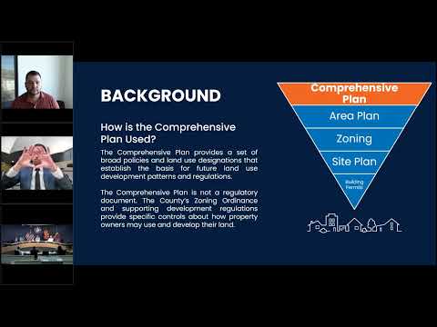
"The comprehensive plan is a state mandated plan," consultant Matt Kliesico said, describing the plan as the county's long-range policy document that guides decisions about land use, circulation and water for unincorporated Maricopa County. Kliesico told the commission the project team has completed phase 1 (existing-conditions analysis and outreach) and is preparing to move into phase 2, saying, "we're just kind of finalizing our phase 1 effort."
Why it matters: the comprehensive plan applies to the county's unincorporated area — not municipalities — and the update will shape policy that county staff and the commission use when reviewing zoning and subdivision proposals. County staff and the consultant emphasized the update is intended to align the county's long-term vision with current data, anticipated growth and other departmental master plans.
Key findings and data presented
- Geographic scale: Maricopa County covers more than 9,000 square miles; unincorporated Maricopa County is roughly 6,600 square miles, the presenters said.
- Growth and density: Maricopa Association of Governments (MAG) population projections show continued population and employment growth through 2060, though at slower rates than earlier decades. The team reported unincorporated-area population density rose from about 40 people per square mile (2010) to about 44 (2022).
- Annexation since 2010: the team quantified about 65 square miles annexed into municipalities from 2010–2022 and noted that municipal planning-area boundaries (areas cities/towns identify they may annex in the future) sit inside the present unincorporated area.
- County islands: the county has numerous unincorporated "county islands" — small parcels of unincorporated land surrounded by municipalities. The presentation identified 432 county islands smaller than 500 acres, many under 100 acres.
- Where growth is occurring: a county heat map of population change (2010–2022) shows much of the recent increase concentrated in the West Valley, particularly along the SR-303 corridor; the East Valley has less unincorporated land available for growth.
- Existing land use: MAG-derived land-use data shows large swaths of open space and significant vacant land in unincorporated areas; agricultural lands remain sizable though much smaller proportionally than open space.
- Housing affordability: countywide (incorporated plus unincorporated), roughly 30% of households spend 30% or more of household income on housing — nearly 500,000 households, the consultants reported. About 14% of households spend 50% or more on housing. The team said survey and outreach responses flagged affordability as a higher priority than availability for many residents.
Infrastructure, water and public-safety concerns
Commissioners pressed staff and the consultant on annexation mechanics and responsibility for infrastructure and services. County staff explained annexation law and practice, saying that annexation is a process between property owners and the municipality and that the county is not a direct party to the statutory annexation petition process. As staff summarized, "Annexation is up to the property owners as well as the municipalities themselves."
County staff and commissioners raised public-safety and infrastructure issues tied to unincorporated growth: fire protection, sheriff coverage, aging local streets and the availability of water and sewer for new development. The presenters recapped that new development must show a certified 100‑year water supply under state-linked subdivision rules; at the comprehensive-plan level staff said the county will consider policy language supporting sustainable water stewardship and alignment with state regulation.
Public outreach and next steps
The Framework2040 team described a three-phase public process and a suite of outreach tools already deployed: a countywide virtual kickoff in early November, an in-person meeting in each supervisor district, an "idea wall" (online pinboard for resident comments), an interactive map where residents can drop pins to identify local concerns and priorities, and an online survey. Staff said those in-person meetings recorded lower attendance than virtual participation (a trend since the pandemic) but that online engagement — "hundreds of clicks" on materials and substantial idea-wall comments — has been strong.
The project website is framework2040.com. The team said the overall update timeline aims for final adoption in spring 2026, with a round of preliminary feedback to the public and the commission in spring 2025 as staff moves into phase 2.
Opportunities for commissioners
County staff invited commissioners to join a Technical Advisory Committee (TAC) of county departments and stakeholders; the TAC meets periodically to review materials and act as a sounding board. Commissioners interested in participating were asked to notify staff.
What commissioners asked and what staff said
Commissioners sought clarification about the county's relationship with municipalities on infrastructure and annexation, whether residents benefit financially by remaining unincorporated, and what the county can do about developers using small-lot subdivisions to avoid water‑supply certification requirements. Staff said perceived tax advantages to remaining in the county often balance against private subscriptions for services (trash hauling, private fire protection) and that changes to the state-level 100‑year water-supply requirement would require legislative action.
Bottom line
The presentation framed the Framework2040 update as data-informed and community-driven. The team asked the commission to review outreach findings and provide policy direction as staff develops draft goals and policies in phase 2. The next formal material the commission can expect is preliminary outreach findings and draft policy directions in coming months, leading toward public review and the statutory adoption process through 2026.