Get Full Government Meeting Transcripts, Videos, & Alerts Forever!
Get email alerts on the Creek Buffer Ordinance topic
No spam. Unsubscribe anytime.
Santa Barbara Creeks Advisory Committee reviews draft citywide creek buffer ordinance; staff seek public input, no vote taken
Summary
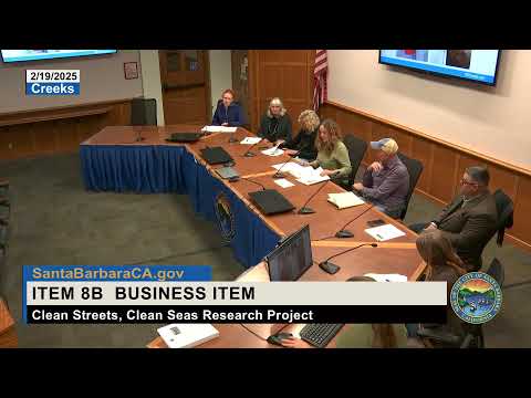
City of Santa Barbara staff presented a draft citywide creek buffer ordinance to the Creeks Advisory Committee and invited committee feedback and public comment; the committee took no formal action and staff said they will revise the draft after the public comment period ends.
City of Santa Barbara staff presented a draft citywide creek buffer ordinance to the Creeks Advisory Committee and invited committee feedback and public comment; the committee took no formal action and staff said they will revise the draft after the public comment period ends.
Melissa Hetrick, resilience program supervisor for the City of Santa Barbara, told the committee that “the benefits of creek buffers are that they reduce public safety risks associated with ... erosion and flooding from fast moving creeks,” and that the draft is intended to provide clear, objective standards to replace a case-by-case approach tied to technical reports.
The draft would apply citywide except in the airport area, staff said, and mirrors buffer distances already certified in the Coastal Land Use Plan for the coastal zone. Proposed minimum buffer distances in the draft ordinance are 50 feet from top of bank for listed major creeks, 35 feet adjacent to public flood-control project reaches, and 15 feet for minor creeks. Staff said the ordinance applies only to daylighted (above-ground) creek reaches and that the public map provided is a screening map, not the final on-the-ground determination.
Why it matters: staff said clear, objective buffers were recommended by the city’s housing element and put into the Coastal Land Use Plan to reduce uncertainty for applicants and to better protect creek habitat, water quality and public safety. Melissa Hetrick outlined the approval path: after revision following public comment, staff will return the ordinance to the Creeks Advisory Committee and the Sustainability Council for recommendation, then the Planning Commission, the Ordinance Committee and City Council; an LCP (Local Coastal Program) amendment and certification by the California Coastal Commission are required for the ordinance to take effect in the coastal zone.
Key technical and policy points
- Applicability and thresholds: staff said the ordinance applies to new development and “substantial redevelopment” while allowing maintenance and limited repairs or additions outside the buffer; the draft includes a modification process for severely constrained lots.
- Top-of-bank methodology and mapping: Aaron Markey, Creeks manager, said “we have a new methodology, to more objectively and clearly be able to determine the top of bank.” Staff explained the publicly posted creek layer was created in the 1990s as a screening tool and that the ordinance’s field definition of “creek” governs applicability; they invited property owners to submit site-specific information if the map is inaccurate.
- Housing, ADUs and safety findings: staff said the lack of objective hazard criteria had been identified in the housing element as an impediment to housing projects, and the ordinance aims to provide objective hazard and environmental protection standards. The draft includes standards for accessory dwelling units (ADUs) and multifamily development: where state-mandated ADUs or densities cannot be located outside buffers, the draft allows them with required technical reports and safety findings and with conditions to place units as far as feasible from creeks.
- Parcel impacts: staff reported an initial parcel analysis showing roughly 2,300 parcels within proposed buffer areas citywide; about 2,000 parcels are inland (roughly 8% of city parcels); staff estimated about 40 parcels would be so constrained that existing square footage could not be rebuilt outside the buffer without a modification.
Public comment and committee concerns
- Opposing views: Jarrett Goran (Vanguard Planning) criticized the draft as overly restrictive, saying, “This ordinance, it turns property owners into lawbreakers,” and arguing the process could impose discretionary reviews that conflict with state housing and ADU requirements.
- Safety and unintended consequences: Skyler Nathan, a resident, said the draft could discourage homeowners from replacing aging structures or push some owners to build without permits, warning that “the Creek Buffer Ordinance, as written, will incentivize ... the preservation of outdated structures built to old standards and the creation of illegal structures built to no standard at all.”
- Institutional impacts: Nicole Burgeoll (SEPS Land Use Consulting) asked the committee to consider carve-outs or streamlined review for museums, gardens and other public-serving institutions sited along creeks, noting that many institutional campuses could fall within expanded buffers.
- Mapping, notification and timing concerns: multiple commenters and committee members raised concerns about the age and accuracy of the creek screening map, the 1990s top-of-bank layer, and the timing of notice (staff said mailers went out and one open house was held Feb. 5). An online commenter, Steve Johnson, urged updated top-of-bank methods, saying the “45 year old language leads to absurd results.”
Committee feedback and next steps
Committee members asked staff to tighten definitions such as “feasible,” to clarify how safety findings will consider future climate-driven changes in storm intensity and erosion, and to clarify how the city will provide customer service and site-specific assistance for property owners. Staff said the city is pursuing a separate adaptation study to model changing rainfall patterns and that the modification and technical-report process will require findings showing safety for the life of a structure.
Because this item was posted for discussion, the committee did not vote; staff asked the public to submit written comments through the public comment period (staff said that period ends March 10), and staff will return the revised draft to the committee and Sustainability Council before beginning the formal approval sequence.
Ending
Staff closed by encouraging interested property owners and stakeholders to contact the creeks team with parcel-specific questions and to use the online resources posted for the draft ordinance. The committee will consider the revised ordinance in a future meeting.