Get Full Government Meeting Transcripts, Videos, & Alerts Forever!
Get email alerts on the Comprehensive Plan Adoption topic
No spam. Unsubscribe anytime.
Caldwell council continues vote on updated comprehensive plan after hours of testimony
Summary
After about three hours of staff presentation and public testimony, the Caldwell City Council continued action on a proposed comprehensive plan update to Feb. 18, asking staff to refine boundary and transition-area language and to return with a single map amendment for further public comment.
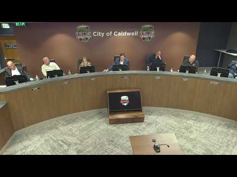
The Caldwell City Council on Feb. 11 heard a detailed presentation from planning staff and consultants on a proposed update to the city's comprehensive plan and future land use map, then received more than an hour of public testimony before voting to continue the item to the council's next meeting on Feb. 18 for additional consideration of map boundaries.
The proposal, presented by Morgan Biesau of the city's planning and zoning staff and Miriam McGilvray of Logan Simpson (the consultant team), would replace the existing 2040 plan and make multiple changes to the future land use map including new mixed-use and employment center designations, a slight northward extension around the municipal golf course, and revised neighborhood place types with new base density recommendations and an optional density-bonus program to be adopted later by code.
The plan is intended to guide land-use decisions for the next 10 to 20 years; staff emphasized that the comprehensive plan itself does not rezone property or change existing permitted uses. Biesau told council that the plan is a guide and that any code changes needed to implement the plan's recommendations would be brought back to planning and zoning and council for public hearings and adoption. Consultant Miriam McGilvray said the update grew from an 18-month public process and described chapters on land use, transportation, parks and river corridor, economic development, and implementation.
Why it matters: the plan would change the city's base density guidance, identify new areas for employment and mixed use, and create a pathway for future code-based programs (for example, a density bonus program) that could alter how developments are reviewed and what community benefits are required. Because code amendments following adoption would be the legally enforceable steps, council members and many residents focused on how the plan's guidance would interact with future ordinances.
Key details
- Public participation and supporting materials: staff said outreach began in late 2023 with multiple surveys, pop-up events, interviews and workshops. The consultants reported 96 online comments and 41 event comments on draft materials; staff said they made roughly 258 minor edits to the draft based on review. For the noticed final draft that generated the Feb. 11 hearing, staff said they received 19 letters or emails (two fully supportive; the remainder supportive or opposed to portions affecting individual properties).
- Density and bonuses: the draft plan proposes revised base density ranges by place type. Staff clarified that the plan would not itself create a density-bonus program; any bonus system and its eligibility criteria (examples discussed included deed-restricted affordable housing, parks or school land dedication, or conservation area preservation) would require separate code amendments and public hearings. Staff noted an existing protection: a 25-foot maximum building height cap currently applies where non-single-family uses abut single-family homes and would not change unless council amends code.
- Conservation-area approach: staff described a proposed conservation-area development option for the low-density Neighborhood 1 place type that would require preservation of roughly 40% of a site in permanent open space to receive a higher clustered density on the remainder.
- Map edits: staff said they corrected map errors in the packet and changed some labels (for example, replacing the term "conservation easement development" with "conservation area development" to preserve flexibility while the city drafts code). One specific map change noted in the presentation: a segment of Simplot Boulevard between South Kitt Avenue West and Wagner Road was shifted from mixed-use to an employment-center designation.
Public concerns and themes
More than a dozen speakers raised recurring concerns about density, neighborhood transitions, infrastructure and notification: several residents urged larger buffer areas between new higher-intensity uses and existing single-family neighborhoods; industrial and agricultural stakeholders asked that established light-industrial areas (near Simplot, Painter and Shaver) remain protected from mixed-use or residential conversion; farm and property owners urged protection of agricultural lands on the city's west edge and questioned expanding the planning area; and multiple speakers requested clearer safeguards on how the plan would affect future rezones, traffic, impact fees, schools, police and fire service demands.
Representative public comments included property owner Ron Graves, who told council he supported the plan overall but asked that Neighborhood 1 density be increased to 4 dwelling units per acre and that the western edge of Neighborhood 2 be aligned with the Caldwell-Deer Flat Canal right-of-way rather than a measured offset from Farmway Road. Carrie Smith of Growing Together, a local nonprofit, urged stronger implementation language for protecting agricultural-production businesses and encouraged ordinances to promote infill and discourage piecemeal annexations.
Several industrial business owners (including George Crookham and Jim Moore) asked that land around Simplot, Painter and Crookham Street remain or be designated for light industry given 24/7 operations and truck traffic. Multiple residents and council members asked for clearer transition rules (setbacks, height and buffering) to prevent two- and three-story multi-family buildings immediately adjacent to single-family yards.
Council action and next steps
After closing public testimony, the council discussed options and motions. By majority vote the council continued the comprehensive plan item to the Feb. 18 council meeting; the council specified that the limited focus of the next meeting's discussion will be map boundary and transition-area adjustments identified during the Feb. 11 hearing. Staff said they would prepare a revised map and supporting materials for the Feb. 18 meeting and that any further code amendments (such as a proposed density-bonus ordinance, multifamily development standards, or ADU rules) would return as separate items with full public hearings.
Actions recorded at the hearing
- Motion to close the public testimony portion of the hearing (motion seconded and passed during the meeting). (Mover/Second: not specified in the record; outcome: approved.)
- Motion to continue/ postpone the comprehensive plan hearing to Feb. 18, 2025; discussion at that meeting will include map boundaries and transition-area modifications identified at the Feb. 11 hearing. (Mover/Second: not specified in the record; outcome: postponed.)
What council asked staff to do next
- Prepare a map revision that reflects the boundary and transition-area questions raised at the Feb. 11 hearing (staff indicated they could have a revised map within a week).
- Draft and return specific code amendments separately (density-bonus program, multifamily development standards, ADU rules and other implementing ordinance language) following council direction; staff reiterated that code changes will require additional public hearings before planning and zoning and city council.
Context and background
Biesau and the consultant team said the update began formally in October 2023 after repeated comp-plan amendment requests showed the existing plan no longer matched market conditions and community goals. The plan includes eight chapters and multiple appendices (existing conditions, health assessment funded in part by Blue Cross Blue Shield of Idaho, economic analysis, engagement summary and a regulatory-takings checklist). The Planning and Zoning Commission reviewed the draft on Jan. 8 and recommended approval with a condition to provide more information about a proposed density-bonus program.
Ending
Councilmembers and staff said they valued the lengthy public participation and asked residents and stakeholders to review the revised materials when they are posted. The council will revisit the map-boundary questions on Feb. 18 and return later for separate public hearings on any implementing code changes.