Get Full Government Meeting Transcripts, Videos, & Alerts Forever!
Get email alerts on the Sitla Larry H Miller 3canyons topic
No spam. Unsubscribe anytime.
Trust and Larry H. Miller outline “3 Canyons” concept for 1,200‑acre Sitla property in Saratoga Springs
Summary
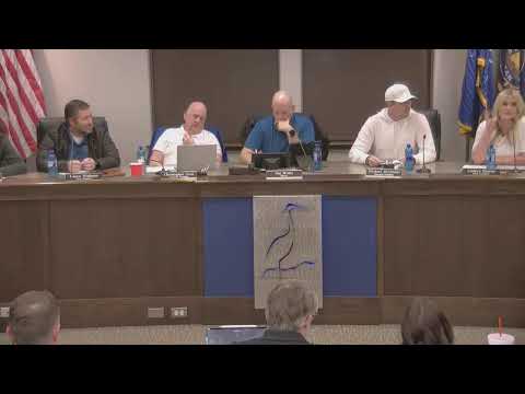
City leaders and planning commissioners met Feb. 11 for a joint work session to review a concept master plan for the Sitla property in Saratoga Springs, presented by the Utah Trust Lands Administration and Larry H. Miller Real Estate.
City leaders and planning commissioners met Feb. 11 for a joint work session to review a concept master plan for the Sitla (State Institutional Trust Lands Administration) property in Saratoga Springs, presented by the Trust Lands Administration and Larry H. Miller Real Estate.
The proposal covers roughly 1,200 acres and would preserve much of the mountainside as park and trail space while concentrating housing on land the applicants describe as developable — about 1,022 acres — at an average of 3 units per acre, the presenters said. The team described a concept it calls “3 Canyons” that aims to pair regional trails and recreation access with mixed housing types, localized commercial nodes and stormwater/debris basins to reduce flood risk.
Why it matters: The property sits at the city’s northern edge and touches future Mountain View Corridor alignments. The plan’s transportation, drainage and school‑site implications drew the most sustained questions from councilmembers and planning commissioners: leaders said they want to avoid overloading existing roads, ensure adequate school capacity and confirm water and sewer engineering before any application proceeds.
What the presenters said
Michael Harold of the Trust Lands Administration opened with agency context and a reminder of the trust’s fiduciary mandate. "Our mission is to enhance the value of those trust lands and maximizing the economic returns to our beneficiaries," Harold said, and described the trust as a long‑term landowner and revenue source for beneficiaries such as public schools and state higher‑education institutions. He said the trust manages roughly 3,400,000 surface acres and about 1,000,000 acres of mineral estate and noted the trust’s permanent fund has grown from roughly $50 million when the agency was created to multiple billions today.
Brad Holmes, president of Larry H. Miller Real Estate, and Steven James, described as the project’s chief visioning officer, said the team’s outreach found local interest in trails, mountain access and a plan that would not overburden schools and roads. "I am the President of Larry H. Miller Real Estate. We do all the real estate development for the Miller family," Holmes said. Steven James framed a central question for the workshop: "what if this piece of land could really be seen as a regionally significant park that integrates the mountainside and development as a way to achieve it and accomplish it." The team emphasized lot‑by‑lot master planning rather than large parcel sell‑offs.
Key numeric, land‑use and timing details discussed
- Total site area: ~1,200 acres. Presenters said about 1,022 acres were considered developable (presenters' estimate). - Proposed average density on developable acreage: 3 units per acre (presenters’ target). Council members and staff noted final density calculations will follow city definitions of "developable." One councilmember cited an approximate project buildout figure of 3,066 units when discussing school impacts. - Housing mix: envisioned range from one‑acre and half‑acre lots up to third‑acre lots, with smaller attached products (duplexes/triplexes, cottages and clustered attached housing) concentrated near village centers and neighborhood commercial nodes. - Open space and trails: a proposed Bonneville Shoreline Trail/greenway along the toe of the slope, parkland in the three canyons (Burnt, Lot and Israel Canyons) and trailheads, some public uses (e.g., mountain biking, equestrian facilities, OHV trailheads) identified in outreach. - Infrastructure/timing: presenters estimated the project would likely be built over 10–15 years if pursued; production rates discussed ranged broadly (presenters suggested a methodical pace of roughly 200–400 permits per year as illustrative). The team said some capital (water tanks, transportation funds) would be needed and that reimbursement agreements and other intergovernmental arrangements are possible.
Questions and community concerns raised
Councilmembers and planning commissioners repeatedly emphasized that this was a concept discussion, not a formal application, and asked staff and the applicants to: clarify how the city and applicants would count developable acreage (which affects density); demonstrate how the plan would reduce traffic on Redwood Road by providing redundancy to Mountain View Corridor; identify school‑capacity impacts (presenters showed two school sites on the plan); and address legacy site issues including clay quarries, a construction debris landfill and an active gravel pit that neighbors said is generating dust and truck traffic.
Commissioners asked how trails, OHV uses and informal rifle ranges would be managed if the land becomes public recreation rather than remaining private uses. Presenters said one goal was to aggregate and manage those uses rather than displace them onto other private land.
Engineering and policy constraints
City staff and the city engineer told the group that certain standards (particularly for water and sewer) are unlikely to be relaxed without detailed review; the city’s engineering team said it would weigh operational impacts and long‑term maintenance when staff evaluate any future application. The mayor and staff discussed typical tools such as reimbursement agreements and development agreements for oversizing infrastructure or phasing public improvements.
What’s next
Presenters said they will provide the council and commission with the full slide deck and expect additional work sessions and formal submittals if the team files an application. City leaders said they expect staff to vet specific policy or code requests early so council and the commission can weigh potential deviations from adopted standards. No formal votes or land‑use approvals occurred at the meeting.
Ending
The presenters and elected officials closed by reiterating a shared interest in continuing conversations. The Trust noted that, if the project cannot meet the trust’s fiduciary test, the trust would retain the historic uses on the property until conditions change; presenters characterized that as a financial and operational fallback rather than a preferred outcome.
Speakers quoted in this article are those who spoke during the Feb. 11 work session and are listed in the meeting speakers array below.