Get Full Government Meeting Transcripts, Videos, & Alerts Forever!
Get email alerts on the Land Use Controls topic
No spam. Unsubscribe anytime.
Midcoast webinar presents municipal land-use tools — shoreland zoning, overlays, elevated flood standards and tree ordinances
Summary
Regional planners and local officials described local approaches to reduce climate and flood risks — including stronger shoreland rules in Bremen and Bath, watershed overlay districts in Rockport, phosphorus controls, FEMA Community Rating System participation, and municipal tree ordinances — and discussed practical steps for small towns.
Workshop presenters and local planners showcased a menu of land-use tools municipalities can use to reduce hazard risks and guide development.
The session framed land-use controls broadly as local ordinances, zoning, setbacks, overlays, subdivision standards, conservation easements, density bonuses and transfer-of-development-rights programs that communities can tailor to local goals. Presenters emphasized that Maine’s home-rule authority allows municipalities to adopt standards higher than state minimums.
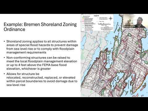
Curtis Brown, land use and transportation planner with the Lincoln County Regional Planning Commission, described Bremen’s shoreland zoning approach and noted that shoreland zoning applies to land within 250 feet of normal high-water lines on ponds, rivers and certain wetlands and within 75 feet of certain streams. Brown said Bremen’s ordinance allows nonconforming structures to be raised to meet local floodplain management elevations or up to four feet above FEMA-based flood elevations, whichever is greater, enabling property owners to preserve investments while meeting updated flood standards.
Dan DeBoer and Max Johnstone of the Midcoast Council of Governments presented local overlay and water-quality measures. DeBoer described Rockport’s watershed overlay districts for the Chickawauk (Chickawauk-related) watershed and Mirror Lake and Grassy Pond watershed districts; those overlays require written erosion-and-sediment-control plans for soil disturbance above 1,000 square feet and defer to the more restrictive standard when shoreland and overlay rules conflict. Johnstone highlighted Waldoboro’s wellhead overlay and river/pond phosphorus-control measures tied to Maine Department of Environmental Protection (DEP) guidance (chapter 500) and described Bath’s updated shoreland rules that require a waterfront setback reduction plan for development within 150 to 75 feet of certain water bodies and add requirements on the west side of town where resource protection and flood projections are greater.
Rachel (presenter) highlighted a model ordinance menu developed by the Southern Maine Planning and Development Commission that offers customizable language for towns of differing size and capacity. The workshop also discussed Hampton, New Hampshire’s March 2024 higher-standard floodplain ordinance, which restricts new critical facilities in mapped special flood hazard areas and raises required base flood elevation requirements above FEMA minima for some facility types, and requires utilities and fuel tanks to be elevated to the structure’s lowest occupied floor.
Presenters recommended the FEMA Community Rating System (CRS) as a voluntary program that can reduce flood insurance premiums for residents when communities document preapproved, above-minimum floodplain management practices. Participants were advised that CRS enrollment can be resource-intensive but is included as a recommendation in Maine’s State Climate Action Plan.
The session closed with a local-practitioner panel. Jeremy Martin, Planning and Development Director for the Town of Camden, described post-storm work after repeated storm events and said Camden adopted stricter pier and harbor rules after several piers were damaged and debris entered adjacent wetlands; the town also is exploring Community Rating System participation and has pursued a multi-million-dollar bond for stormwater infrastructure. Michael Martone, town planner for Damariscotta and Newcastle, described keeping ordinance language clear and objective to improve public understanding and enforcement in smaller towns and discussed form-based code as a tool for predictable building form and simpler public explanation.
Ending: Presenters urged towns to build on existing shoreland requirements where feasible, to consult model guidance and regional planning organizations, and to begin with clear, administrable standards that reflect local capacity and hazard exposure.