Pleasant View Council adopts general plan amendment for 30.6-acre hillside after debate over road, water and notice
Get AI-powered insights, summaries, and transcripts
Subscribe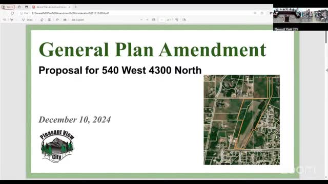
Summary
On Dec. 10, 2024, the Pleasant View City Council voted unanimously to amend the general plan for 30.6 acres at 540 West/43100 North from Rural Residential 5 to Rural Residential 2, drawing public comment about water recharge, notice and who will pay for a planned road.
Pleasant View City Council on Tuesday, Dec. 10, 2024, voted unanimously to adopt a general plan amendment to reclassify about 30.6 acres at approximately 540 West and 43100 North from Rural Residential 5 (A5) to Rural Residential 2 (A2). The change reduces the target lot size density from “0–1 unit per 5 acres” to “0–1 unit per 2 acres,” a move council members said could enable a developer to meet a legal test for requiring roadway improvements tied to the proposal.
Council members and staff framed the vote as a procedural step to resolve a conflict between the city’s road master plan and the density shown in the applicant’s concept. Amy, the city administrator, told the council that legal advice applied the Nollan/Dolan exaction standard — a Supreme Court framework comparing the public improvement sought to the impact created by a development — and that lowering density to an A2 classification was one of the administrative options likely to allow the city to require a roadway exaction tied to the project.
The amendment drew extensive public comment. Several residents urged the council to delay the change and pursue a broader general plan update and additional public outreach. Concerns focused on the hillside’s role as a groundwater recharge area and on the age and local applicability of the city’s sensitive-lands study, which commenters said relies on older regional work. One resident, Lehi Ames, described technical concerns about runoff from roads and roofs and asked the council to “let current residents be part of this.” Another commenter who identified himself as a water engineer urged caution about potential impacts to groundwater recharge.
Planning commission proceedings preceded the council vote. The planning commission recommended approval by a 5–2 vote; two commissioners, Farr and Carter, dissented, citing concerns about site-specific environmental impacts and the need for a fuller general plan update and public input. Amy said the commission had initially tabled the item to complete review of the adopted sensitive-lands plan and confirming noticing requirements under state law.
Amy told the council that one option would be to reduce the general-plan density to A2 so that a legal exaction for the road could be matched to the development’s impact. She said city engineering estimated the city’s acquisition and construction portion for the roadway at about $1.4 million. She also described other options the council could consider: (1) require the road by matching the exaction to impact, (2) fund the road from city funds, (3) remove the planned roadway from the general plan, or (4) identify a different, undefined option.
Council members who spoke described the trade-offs. Supporters of the amendment said an A2 designation would better align the property with surrounding zones and that infrastructure placed by a future developer could help the city’s long-term road plan. Opponents and several public speakers warned that A2 would allow more potential lots (council discussion estimated roughly a difference of about 10 additional homes versus the A5 scenario) and that subdivision-level environmental studies required by the city’s sensitive-lands policy should drive final determinations about groundwater and slopes.
The council adopted the amendment by roll-call vote after a motion by Arrington and a second by Nelson. The roll call recorded: Arrington — yes; Gibson — yes; Mariette — yes; Nelson — yes; Urie — yes. The council also approved routine consent items earlier in the meeting and later voted to go into a closed session to discuss character/competence and property acquisition.
The amendment does not by itself authorize subdivision or construction. Staff noted that if the developer later pursues an A5 subdivision or otherwise finds the A2 option uneconomic, the developer may pursue the development allowed under the existing zoning; subdivision-stage reviews and site-specific environmental studies remain required. Staff also relayed advice from the State Ombudsman that, at the time an application is filed, the city cannot indefinitely delay action: if the city wants the road, the city would need to pay its portion or otherwise address the exaction responsibilities when development applications proceed.
Votes at a glance - Consent items (minutes of Nov. 26, 2024; bills): Motion by Marriott, second by Erie — motion carried (voice vote). - General plan amendment (2024‑25) — reclassify ~30.6 acres at ~540 West/43100 North from Rural Residential 5 to Rural Residential 2: Motion by Arrington; second by Nelson. Roll-call vote: Arrington, Gibson, Mariette, Nelson, Urie — all yes. Outcome: approved. - Closed meeting: Motion to go into closed session to discuss character/competence and property acquisition — motion made and carried (roll-call affirmative votes recorded).
Next steps noted during the meeting: if a developer files a subdivision application, site-specific environmental studies and engineering design will be required at subdivision review; those studies will test sensitive-lands and recharge concerns raised by residents. The council also said it plans a general plan update in the coming year, which would provide a broader venue for public input on hillside policy and master-plan roads.