Get Full Government Meeting Transcripts, Videos, & Alerts Forever!
Get email alerts on the Flood Mitigation topic
No spam. Unsubscribe anytime.
Coconino County flood-control work moves to construction for Switchback neighborhood; major storm drain, detention basin and forest restoration planned
Summary
Coconino County Flood Control District staff said construction is starting on a long‑planned flood‑mitigation system for the Switchback area northeast of Flagstaff that pairs on‑forest watershed restoration with a new neighborhood storm drain and a 77 acre‑foot detention basin.
Coconino County Flood Control District staff said construction is starting on a long‑planned flood‑mitigation system for the Switchback area northeast of Flagstaff that pairs on‑forest watershed restoration with a new neighborhood storm drain and a 77 acre‑foot detention basin.
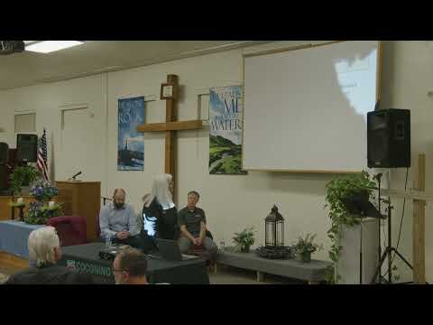
District staff and project engineers told about 60 residents at a Jan. 16 public meeting that much of the design is complete, funding is in place and contractors are scheduled to begin work this month and into spring. “We’re here tonight and very good news that we’re moving into construction,” a district presenter said.
The work responds to heavy post‑wildfire runoff and the major 2022 flood season, when the corridor suffered among the largest storm impacts recorded by the district. Engineers said the combined program is intended to reduce peak flows that reached neighborhoods and Highway 89 and to restore sediment‑holding functions higher in the watershed.
What’s being built
Remel Consulting engineer Eli Reisner said the neighborhood measures include a large, buried storm drain about 3,000 feet long and 10 feet in diameter that runs down Switchback, crosses Highway 89 by tunneling and outlets to a detention basin on the 17‑acre “Tract A” parcel. “The storm drain is a 3000 feet long and a 10 foot diameter storm drain ... and outlets into the large detention basin,” Reisner said.
Reisner said the system is sized to capture a 10‑year design storm defined for the project as 1.6 inches of rain in 45 minutes; during that event the pipe would convey roughly 1,900 cubic feet per second from the on‑forest transition channel into the basin. The basin is designed to route most flows north onto National Forest Service lands across berms and to meter smaller flows south through the existing Johnson Ranch channel. The detention basin’s capacity was given as 77 acre‑feet.
On‑forest measures and sediment control
Alan Hayden of Natural Channel Design Engineering described the on‑forest work uphill of the neighborhood: rock “grade control” structures, alluvial‑fan restoration and a plug‑and‑spread approach that spreads flows across wide fan surfaces so they drop sediment before reaching the neighborhood. Hayden said the upper channels and slopes remain unstable after the fire and that the on‑forest measures “trim down the sediment transport up on the hillside, so that it doesn't come down” into neighborhood pipelines and crossings.
Hayden and district staff said the team has already completed several upstream stabilizations, coordinated work with Transwestern Gas and the City of Flagstaff, and installed earlier plug‑and‑spread structures that have begun trapping sediment. They described the plugs as modest structures (roughly 5–6 feet high in places) that can fill with sediment quickly; Hayden said plugs at a comparable site were about half full after a single snowmelt season and could fill in one large storm.
No‑adverse‑impact criteria, modeling and safety measures
Corey Helton of J.E. Fuller presented the modeling and the project’s no‑adverse‑impact (NAI) thresholds. The project uses a post‑2022 LiDAR topography as a pre‑project baseline and NAI criteria adopted from nationally accepted floodplain‑management guidance. The team said they will not allow increases greater than 0.1 foot for some storms, 0.5 foot for the 25‑year (roughly 2‑inch) event, and 1 foot for the 100‑year (roughly 3‑inch) event in areas subject to the criteria; they also flagged velocities above about 3 feet/second as a concern for erosion.
Engineers said modeling shows that for the 1.6‑inch (10‑year) design storm most flows coming off the mountain are routed into the pipe and detained in Tract A, with remaining flows detained behind the upper berms and returned to the alluvial fan or to the cinder soils east of the highway to promote infiltration. For larger storms (2–3 inches) some over‑topping is expected on fan surfaces and road corridors, but modeling—staff said—keeps increased depths and velocities within the NAI limits and largely off private parcel footprints.
Construction plan, contractors and schedule
District staff said the project combines federal, state and district funding; they stated the combined funding supporting the corridor is about $132,000,000 across multiple district projects (the Switchback corridor is part of that program). Tiffany Construction was named as the selected contractor for the storm‑drain construction; PC Diversified was named as the contractor for the detention basin; D&G Development will construct the detention basin grading; and other firms supporting design include Civiltech Engineering, Remel Consulting and Natural Channel Design Engineering. The Coconino County Flood Control District will maintain the storm‑drain and basin measures (the Johnson Ranch channel remains under other ownership and is not maintained by the district).
Specific near‑term dates repeated at the meeting: - Site test pits for the Highway 89 jack‑and‑bore geotechnical work were scheduled for Friday, Jan. 17 (to be refilled the same day). - PC Diversified was scheduled to begin work on the detention basin the week of Jan. 20. - Lower‑fan plug‑and‑spread restoration work was slated to start in early to mid‑February. - The main storm‑drain pipe work was described as expected to begin in late March or early April, with the highway crossing (jack‑and‑bore) following in April. - The district’s goal is to complete the system by July 1 (before monsoon season), while noting the schedule depends on weather, permitting and construction factors.
Public concerns and district responses
Multiple residents asked about private‑property impacts and cleanup of sediment that had already cut trenches across yards. District staff said the program funds area‑wide mitigation and restoration rather than individualized private‑property repairs; they said they lack authority or funding to perform full private repairs but that excess construction material is sometimes offered to landowners and that engineers can review property‑specific options after the meeting. “We don't have any funding to go on to private properties,” a district presenter said.
Contractor communication and site access
Project managers and Tiffany Construction representatives emphasized daily communication and three‑week look‑ahead schedules to limit surprises for residents, manage temporary access and address specific needs such as mail or horse trailers. Staff said temporary construction access easements on several private properties have been arranged to stage equipment and speed work.
Safety features built into the design include bolted manhole covers, fencing and handrails at large inlet and outlet structures, breakaway fencing at the inlet, equestrian‑safe fencing on a resident‑only access corridor, perimeter fencing on the east and south sides of the detention basin, and post‑event inspections before each monsoon season.
Why this matters
District staff said the combined on‑forest and neighborhood approach restores sediment‑storage function uphill while providing an engineered conveyance and storage system in the neighborhood to reduce flood depths, velocities and peak discharges compared with pre‑project (post‑2022) conditions. Project leaders repeatedly cautioned that no system can prevent all flooding and that very large storms could still produce local flows that exceed the design thresholds.
Plans for follow‑up
Engineers said full construction plans are available at the meeting and that the project team will meet individually with homeowners who have parcel‑specific questions. Presenters asked residents to provide contact emails for construction updates and said meeting materials and a video of the session will be posted online.
Ending
District staff said the combined system reflects multiple years of planning and coordination with federal land managers, utilities and local stakeholders, and they urged residents to use the district’s contact points for questions during construction. The district reiterated its aim to finish major work before the monsoon season but acknowledged schedule risks from weather and permitting.