Get Full Government Meeting Transcripts, Videos, & Alerts Forever!
Get email alerts on the Open Space Trails topic
No spam. Unsubscribe anytime.
Cape Elizabeth shifts from planning to implementation on greenbelt trails
Summary
Cape Elizabeth has moved from aspirational greenbelt plans to focused implementation: the town says it has acquired priority parcels, completed about 19 miles of trails and is using a management plan, an assessment, permits and volunteer labor to upgrade and maintain the system.
Maureen O'Meara, Cape Elizabeth town planner, told a Maine Planning Basics webinar that the town has moved from long-range greenbelt visions to day-to-day implementation of trails and open-space management.
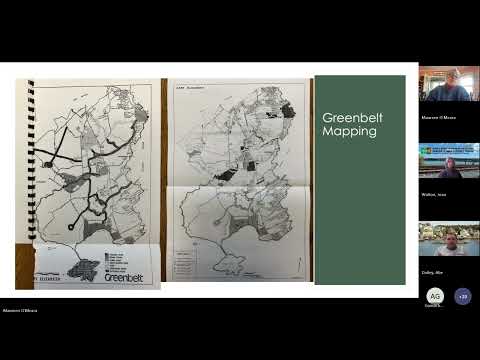
The greenbelt effort began as an aspirational plan in 1977 and evolved through updates in 1988 and 2001 into a program that paired land acquisition with public access goals. "We had 800 plus acres of land," O'Meara said of the early 2000s effort. The 2001 plan prioritized five high-priority acquisitions; O'Meara said the town has since acquired all five.
Why it matters: O'Meara said the shift matters because owning land without providing public access limits the public benefit of that open space. The town has moved from vision documents to concrete actions — inventory, management policies, capital improvements and permitting — to make trails usable and maintainable.
The town now has about 19 miles of trails and a 2012 greenbelt management plan that sets permitted uses (including where hunting is allowed) and standards for types of trail infrastructure. During the pandemic, trail use increased and the town responded with a capital improvement approach: the town contracted FB Environmental to complete a greenbelt assessment, which identified failing boardwalks, sections needing new boardwalks, and other upgrades. O'Meara said the assessment has been used as the basis for multi-year improvements.
The town also obtained a master permit from the Maine Department of Environmental Protection for its four largest properties and has used a mix of volunteer labor, nonprofit partners and contractors for upgrades. Volunteers and Boy Scouts have completed work for Eagle Scout projects, and the Maine Conservation Corps assisted for several seasons, O'Meara said. The town is also constructing machine-built trail on existing alignments to improve passage where trails had eroded.
Public controversy over routes has shaped implementation. A 2013 update that showed potential trail links prompted intense opposition when it included waterfront connections and paper streets. O'Meara described waterfront proposals and the use of recorded but never-built "paper streets" as especially contentious: residents raised concerns about privacy, property values and perceived threats to ownership rights. The town subsequently inventoried paper streets, extended or vacated incipient municipal rights in some places and retained pedestrian access in others.
O'Meara emphasized the need for clear management policies: the town's 2012 management plan provides a shared reference for questions about uses, trail classifications and responses to conflicts. She said the town prefers to implement existing plans rather than start new versions, noting, "we've got a great implementation plan, and so that's what we're doing for now." She added that GIS mapping and clear signage have helped residents find trailheads and understand permitted uses.
Ending: O'Meara described the greenbelt effort as an ongoing mix of maintenance, opportunistic land acquisitions (including many through development review), volunteer stewardship and periodic capital projects. She urged municipalities to pair vision with specific priorities and implementation assignments so plans translate into maintained public access rather than documents that sit on a shelf.