Get Full Government Meeting Transcripts, Videos, & Alerts Forever!
Get email alerts on the Creek Buffers topic
No spam. Unsubscribe anytime.
Santa Barbara staff present draft creek-buffer ordinance; public comment highlights housing, fire and property concerns
Summary
City staff presented a draft citywide creek-buffer ordinance intended to standardize setbacks, reduce erosion and protect riparian habitat. Staff said roughly 2,300 parcels citywide could be affected; public commenters and committee members raised questions about housing law, wildfire mitigation and how minor creeks will be defined.
City staff presented a draft creek-buffer ordinance during the Santa Barbara City Sustainability Committee meeting on Feb. 6, 2025, describing a proposal that would set minimum setbacks from creeks across most of the city and create an objective, ministerial process for many routine permits.
The ordinance would apply citywide except for the airport area, staff said, and would replace the existing Mission Creek ordinance. "We're here to talk about a draft Creek buffer ordinance that we have put out for public review," said Melissa Hetra, a senior program director in the city's creeks division. The public review period is open through March 10, staff said.
The nut graf: Staff told the committee the draft aims to reduce erosion and flooding risk, improve water quality and protect riparian habitats by establishing clear, numeric buffers and a modification process for constrained lots. The changes would extend into inland areas policies already used in the Coastal Land Use Plan, and staff emphasized the intent to make criteria objective so many approvals could be handled ministerially.
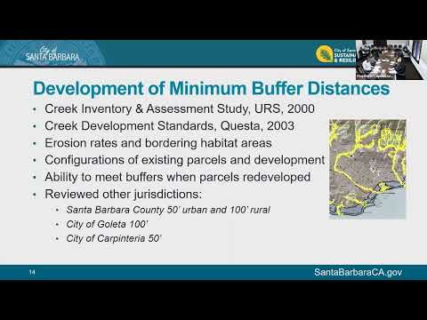
Staff described three primary buffer distances modeled on the Coastal Land Use Plan: 50 feet from the top of bank for major creeks, 35 feet for public flood-control reaches, and a smaller buffer for minor creeks that meet the state definition of a creek. Staff said the ordinance would allow certain activities without prior approval — debris and vegetation removal for flood control, fuel modification for fire safety, minor native-planting and maintenance of existing roads, trails and utilities — and would allow habitat restoration, public access trails, ADA improvements and stormwater best-management practices through a zoning clearance or staff-level approval.
"One of the biggest goals of this ordinance was to make an objective ordinance that could be applied ministerially," Hetra said, adding that the ordinance is intended to reduce uncertainty for applicants, staff and decision-makers.
Staff said they began with interdepartmental review and released a draft for public comment in January. They mailed notices to property owners within about 75 feet of mapped creeks and held a public open house the night before the committee meeting. The screening map provided to the public distinguishes major creeks (dark blue), public flood-control reaches (purple) and minor creeks (light blue); staff said the screening map is not the ordinance and that the ordinance applies only to daylighted (above-ground) creek reaches.
Staff reported a GIS parcel analysis showing about 2,300 parcels citywide that would fall within the proposed buffer distances based on the city's existing blue-line creek layer; inland-only parcels numbered about 2,000, staff said. The analysis indicates that fewer than half of those parcels are adjacent to major or flood-control creeks and that more than half are mapped along minor creeks. Staff estimated roughly 40 parcels could not accommodate their existing development outside the proposed minimum buffers and therefore might need a formal modification.
Committee members and the public raised several recurring concerns. Jared Warren of Vanguard Planning, a public commenter who said he lives next to a creek, said the draft would affect a far larger number of homeowners than the staff presentation indicated and that the ordinance could substantially limit routine backyard uses on smaller lots. "These buffers... effectively prohibit basically any use of your property that's within the buffer," Warren said during public comment.
Committee members pressed staff on specifics. Several asked how the ordinance would interact with the city's floodplain regulations, changes in rainfall and the frequency of extreme events, and debris-flow hazards. Staff explained the distinction between the ordinance's erosion and bank‑stability focus and separate floodplain rules that implement FEMA and state guidance for base flood elevations and floodways. "Our floodplain regulations are consistent with FEMA and Cal OES," a staff presenter said, and debris‑flow mapping for the city is limited; Montecito has completed detailed debris‑flow mapping after its 2018 disasters, but Santa Barbara lacks equivalent citywide datasets.
Committee members also asked about the ordinance's interaction with state housing and accessory-dwelling-unit (ADU) law. Staff said the ordinance creates a modification pathway — reviewed by the planning commission — for cases where state-mandated housing density or ADU standards would otherwise be blocked by the buffer. Staff noted a procedural difference between ministerial approvals and discretionary actions: if a project is purely ministerial, CEQA and discretionary studies are not triggered in advance; if a modification is requested, the project becomes discretionary and subject to CEQA review.
On wildfire and fuel-reduction questions, staff said vegetation clearance for fuel modification and fire-safety requirements would be allowed without advance approval. "You can do that without any approval," a staff member said, referring to vegetation and fuel-modification allowances written into the draft.
Staff emphasized the draft includes objective definitions (for example, top of bank) and a modification process that, they said, had been successful in the coastal zone where similar rules were adopted as part of the Coastal Land Use Plan. They noted the ordinance is not intended to prohibit rebuilding after a disaster but to require attempts to move structures farther from creeks when feasible.
Next steps: staff said they will continue to take public comments through March 10, revise the draft as needed, bring the draft to the Creeks Advisory Committee in February, then to the planning commission and ordinance committee, and ultimately to city council. Staff warned that a local coastal program amendment and Coastal Commission review will be required for ordinance provisions that affect the coastal zone.
Why it matters: the draft would standardize how setbacks are measured and enforced across most of Santa Barbara, potentially affecting thousands of parcels, altering permitting for redevelopment on creek‑adjacent lots, and creating a formal process for reductions where lots are constrained. Committee members urged staff to seek clarifications on ADU state law and to refine the screening map and the definition and mapping of minor creeks.
Public comment and committee discussion will continue as staff refine the draft and return to subsequent advisory and decision-making bodies.