Get Full Government Meeting Transcripts, Videos, & Alerts Forever!
Get email alerts on the Stormwater Drainage topic
No spam. Unsubscribe anytime.
Board presses developer for more drainage detail on Lexington/Concord subdivision; SEQR conversation continues
Summary
The Saratoga Springs Planning Board told the developer of a planned Lexington/Concord subdivision that the stormwater and drainage information submitted for SEQR is not adequate and asked for detailed drainage engineering drawings and a face‑to‑face review with city staff.
The Saratoga Springs Planning Board spent the largest portion of its meeting reviewing part 2 of the SEQR (State Environmental Quality Review) for a proposed multi‑lot subdivision in the Lexington/Concord area and concluded it needs more detailed drainage documentation before it can finish its environmental review.
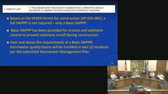
Project representatives, including Bruce Steeves and engineer Dom Areco, presented an overview of the proposed drainage pattern and said the applicant has prepared a basic stormwater pollution prevention plan (SWPPP) with two sediment basins and proposed culverts. Areco described the site’s flow paths, noting several drain lines that collect runoff to a low point; he said the project team had included “about 1,600 square feet” basins intended to capture the first flush of stormwater before it flows to the downstream channel.
Board members and city staff repeatedly raised concerns about the level of detail available in the materials submitted for SEQR. Board member Bill (surname not given) and the city engineer’s reviewer asked for invert elevations, pipe sizes, and clearer, large‑format grading and drainage drawings showing where catch basins discharge and how flows reach downstream receiving waters. The DOT (New York State Department of Transportation) had provided early comments; staff noted DOT’s letter appeared to have been based on prior plan sets and recommended the applicant clarify the record with DOT where needed. The Army Corps of Engineers and the state DEC were already engaged for wetland impacts, the applicant said; the applicant also stated it plans to purchase mitigation credits as required by the Army Corps.
Board members also raised operational questions tied to the wetlands and downstream drainage: the site feeds a low spot and wetlands complex that ultimately connects to larger downstream waters. Several board members flagged potential beaver‑dam maintenance and long‑term access/maintenance concerns for wetlands and drainage features, and asked whether conserving the large wooded area in a single parcel or as a city easement would be administratively simpler than splitting the conservation land across multiple private lots. Staff said conservation easements are typically drafted as a single document that applies across the protected lands, but the details of ownership and maintenance were matters for later subdivision work and potentially the city attorney.
The board unanimously agreed the applicant’s current submission did not yet clear the ‘moderate to large’ water‑related SEQR checkboxes for the record and directed the applicant to provide a detailed drainage report, large‑format construction‑grade drainage drawings showing pipe sizes and inverts, and to meet with city staff (including the city engineer and the board member who raised specific concerns) to resolve outstanding questions. The board also asked staff to consider following up with DOT to clarify which set of plans DOT reviewed.
What’s next: applicant to produce a more detailed drainage submission and to meet with city engineering staff and board members; SEQR remains open pending that supplemental information. Army Corps and DEC wetland permitting work is ongoing in parallel.