Get Full Government Meeting Transcripts, Videos, & Alerts Forever!
Get email alerts on the Environment topic
No spam. Unsubscribe anytime.
Staff proposes reorganized critical-area code and larger riparian buffers; board asks for mapping and decision points
Summary
Planning staff presented a rewritten Title 23 critical-area ordinance that consolidates scattered chapters, proposes moving tree rules into Title 17, and recommends wider, Department of Fish and Wildlife–informed riparian management zones. Staff proposed an 80% native-plant cover standard for enhancements and a conditioned 25% reduction pathway;
What staff presented
Planning staff proposed consolidating the City’s critical-area regulations into a single, reorganized Chapter 23 to reduce cross-references and improve reviewability. Staff recommended moving the tree chapter (currently in Title 23) into the zoning/title 17 chapter for clearer placement and future separate amendments to tree rules.
Riparian management zones and buffers
Citing Department of Fish and Wildlife guidance used by other jurisdictions, staff proposed standardized riparian management-zone widths (larger than the city’s current buffers in some stream categories) and a streamlined approach that avoids burdensome site-level core sampling. For properties that trigger a reduced buffer, staff proposed requiring enhancement so that an average of 80% of the riparian zone would be planted in native vegetation with nonnative species limited to 10% of the total area, and invasive-species removal would be required. Staff noted the 25% reduction pathway is a draft approach and said they will map affected parcels and confirm whether the reduction and enhancement metrics are appropriate given local parcel geometry.
Implementation, monitoring and checklists
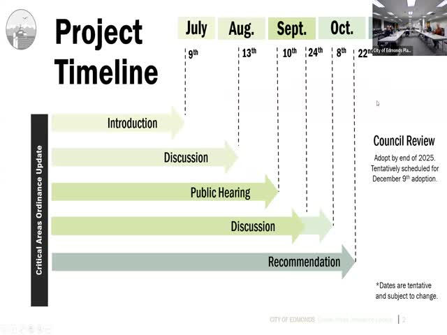
Staff recommended clearer application checklists (modeled on other jurisdictions) to reduce incomplete submittals, a clearer annual reporting template back to Council that outlines monitoring metrics, and additional public-facing flowcharts to guide property owners and applicants through reviews. Staff said adoption is required by year-end to meet state deadlines but also acknowledged stakeholder requests for more time on implementation details.
Board discussion and next steps
Members raised concerns about parcels where the new riparian widths might effectively preclude new development, about how to treat existing developed footprints, and about mitigation strategies that could consolidate enhancement area rather than require uniform widths along a full stream reach. Board members requested that staff prepare parcel-level maps, an itemized list of decision points, and an estimate of how many lots would be affected so the board can provide a recommendation at a subsequent meeting.