Hanford staff unveils transit‑oriented development vision for high‑speed rail station site; residents and school officials raise questions
Get AI-powered insights, summaries, and transcripts
Subscribe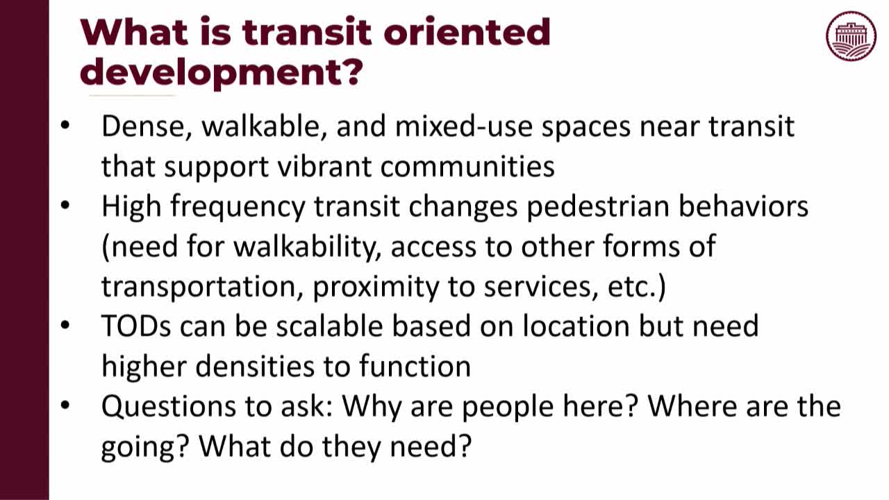
Summary
City planners on Nov. 4 presented a grant‑funded transit‑oriented development vision for land around the planned Kings/Tulare high‑speed rail station, proposing mixed‑use and employment areas, a walkable street grid and green corridors oriented for groundwater recharge.
City planners presented a grant‑funded transit‑oriented development (TOD) vision for the area around the proposed Kings/Tulare high‑speed rail station during the Nov. 4 study session and invited public comment on next steps and timing.
Deputy City Manager Jason Waters and planner Gabby Myers summarized outreach that informed the concept: a $650,000 state grant supported consultant Perkins & Will and a working‑group process that included two public open houses. The draft vision would extend Hanford’s existing street grid east of Highway 43, create a loop network inside the TOD, and emulate downtown block sizes to promote walkability. Planners said they adjusted block orientation to take advantage of prevailing winds for a cooling effect, included shade and continuous bike connections, and proposed green corridors and pocket parks sited to support groundwater recharge as well as recreation.
Land‑use and density concepts: the plan designates a core mixed‑use area close to the station with suggested densities of about 40 dwelling units per acre or more (a broad range was left intentionally flexible), lower‑density residential as distance increases, a production/innovation employment quadrant to attract jobs, and institutional parcels for training or education programs tied to regional ag workforce needs. Staff emphasized the document is a vision—not a binding general‑plan amendment—and recommended that if development interest grows the city would follow with a specific or master plan and infrastructure studies.
Timing, infrastructure and next steps: staff warned that implementation is long term and dependent on high‑speed rail service, utility extension (water/sewer/storm drain), and developer investment. An economist hired for the project concluded that building at the proposed densities could yield a viable return for developers under expected market conditions. Staff expects to deliver a formal vision document before year‑end and to continue outreach; LAFCO and municipal service questions must be addressed if/when land is moved into the city.
Public comment highlighted local concerns: Michelle King, principal at nearby Kit Carson Elementary School, asked to be included in working groups and raised questions about how bus routes, projected enrollment and construction impacts will be handled. Property owners and other commenters asked for clearer boundaries, expressed concern about vague land‑use labels west of Highway 43, and warned of potential costs tied to grade‑separated railroad crossings and Highway 43 upgrades.
No land‑use changes or approvals were made on Nov. 4; staff said the next formal step is a finished vision document and later site‑level planning if development interest materializes.