Get Full Government Meeting Transcripts, Videos, & Alerts Forever!
County staff: rural activity centers are generally well located; board asks use-comparison along US-441
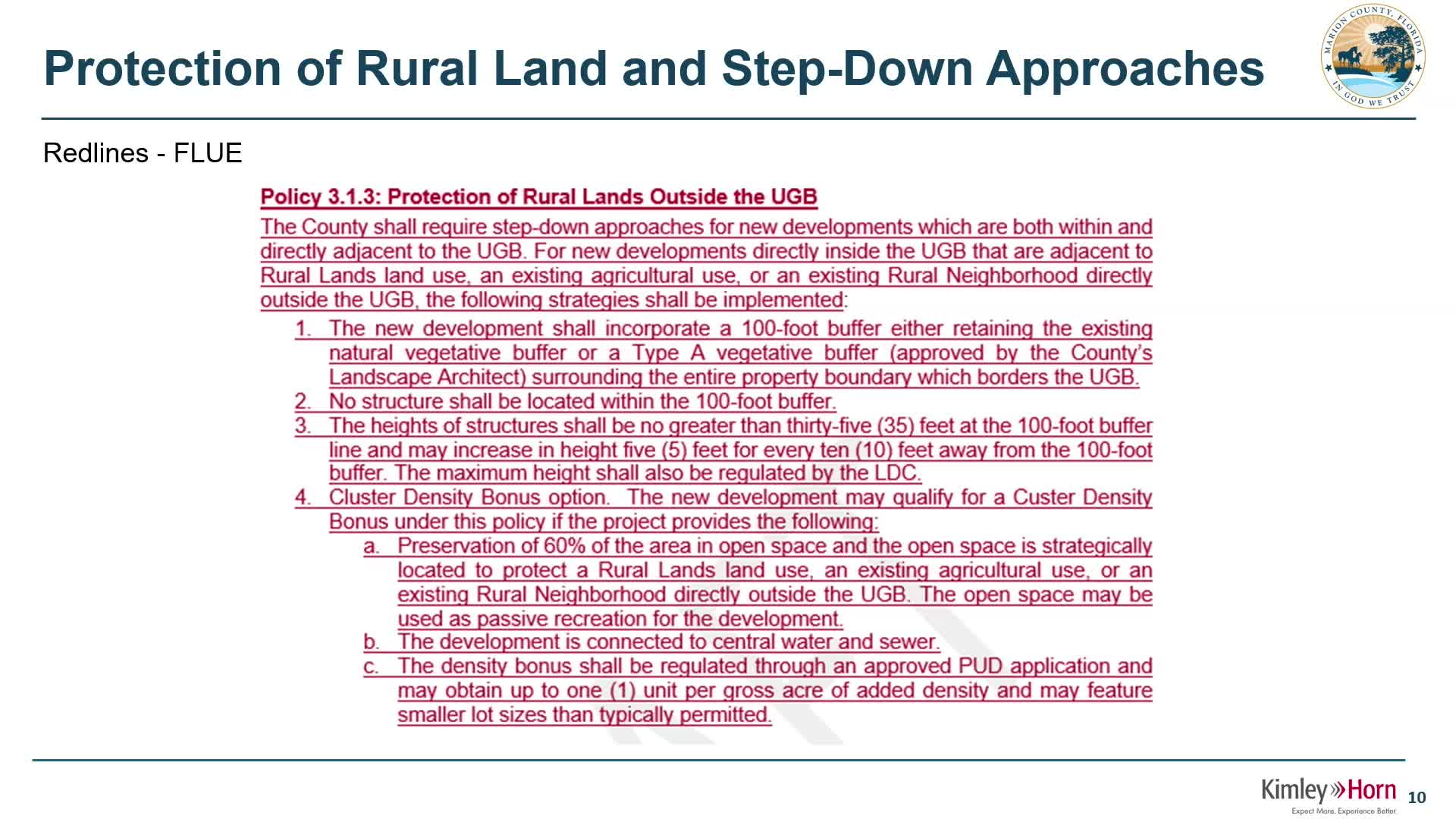
Summary
Staff presented a GIS-based assessment of Marion County's rural activity centers (RACs), mapping each center with a five-mile service buffer. Commissioners asked staff to compare commercial entitlements in existing commercial zoned areas with RAC allowances along the US-441 corridor and to return with a uses comparison.
Marion County planning staff told commissioners that existing rural activity centers (RACs) appear to be strategically located and occupied, based on a GIS review presented at the April 4 workshop.
Ken, who prepared the map, explained he used a five-mile buffer around each RAC. "I used a 5 mile buffer because of multiple reasons. 1, 5 miles in rural areas is not very far. 2, if a rural activity…
Already have an account? Log in
Subscribe to keep reading
Unlock the rest of this article — and every article on Citizen Portal.
- Unlimited articles
- AI-powered breakdowns of topics, speakers, decisions, and budgets
- Instant alerts when your location has a new meeting
- Follow topics and more locations
- 1,000 AI Insights / month, plus AI Chat