Get Full Government Meeting Transcripts, Videos, & Alerts Forever!
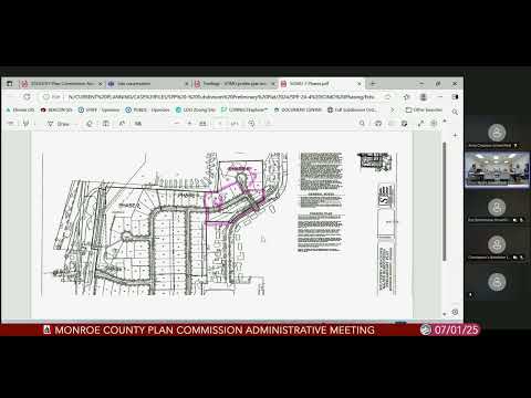
Staff identifies zoning-map error for 3521 South Rogers Street; plan commission to consider public hearing
Summary
Staff told the plan commission that a narrow parcel at 3521 South Rogers Street appears on the county GIS as included in a PUD due to a mapping error; staff recommended the commission review the correction and suggested taking it as a public hearing so that neighbors and the property owner can comment.
Staff presented an apparent zoning-map error showing a long narrow parcel at 3521 South Rogers Street as part of a PUD when review of historical records, GIS, the original subdivision and references to City of Bloomington Ordinance 92-43 indicate the parcel should be in a different…
Already have an account? Log in
Subscribe to keep reading
Unlock the rest of this article — and every article on Citizen Portal.
- Unlimited articles
- AI-powered breakdowns of topics, speakers, decisions, and budgets
- Instant alerts when your location has a new meeting
- Follow topics and more locations
- 1,000 AI Insights / month, plus AI Chat