Experts at Missoula forum: legacy mining, warming streams and rising recreation pressure threaten Clark Fork Basin
Get AI-powered insights, summaries, and transcripts
Subscribe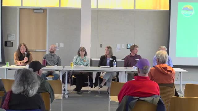
Summary
A multi‑agency panel in Missoula outlined how a century of mining plus shifting climate and rising recreation pressure have combined to stress fisheries, complicate cleanup and require new storage and restoration strategies across the Clark Fork River Basin.
Missoula — Scientists, tribal representatives and state agency leaders told a crowded public forum that the Clark Fork River Basin faces overlapping challenges from legacy mining contamination, changing precipitation and runoff timing, warming stream temperatures and increased recreational use.
At a Clark Fork Coalition event, moderator Brian opened by describing the basin’s scale — “14,000,000 acres, which is 22,000 square miles” — and its history of timber removal and large‑scale mining that, together with a 1908 flood that moved thousands of cubic feet per second of contaminated sediment, left persistent metals on the floodplain. "We are about 110 years into the cleanup of the Upper Clark Fork," Sam Carlson of the Clark Fork Coalition said, noting the long horizon for remediation.
Why it matters: Panelists said the basin’s mix of contamination, flow changes and human use multiplies risk for fish and communities. Caleb Uhrling, Upper Clark Fork Basin fisheries biologist for Montana Fish, Wildlife & Parks, reported declines in some upper reaches — from historical densities near 1,000 trout per mile to roughly 100 per mile in places — while downstream sport fisheries have been relatively stable but still below expectations (often 200–400 fish per mile at monitored sites). He added that "bull trout throughout much of this range have taken a really sharp decline over even just the last 5 to 10 years."
Panel perspectives: Valerie Kurth, the Basin Water Planner for Montana DNRC, emphasized new state work on hydrologic monitoring and modeling, citing efforts to expand the stream gauge network and pilot water‑storage projects. "We are also looking at different approaches to water storage," she said, naming managed aquifer recharge and soil‑storage practices among the options DNRC is exploring. Katie Garson Forba, DEQ’s Superfund bureau chief, described remediation accomplishments — including 26 miles of cleanup on Silver Bow Creek and the Milltown Dam removal — while warning that remedies must be made climate‑resilient: "How do you build in climate resilient remedies and predict the next hundred years?"
Points of contention and constraints: Panelists repeatedly flagged private property, transportation infrastructure and existing water rights as practical limits on river reconnection and floodplain restoration. Chris Stark, staff scientist for the Confederated Salish and Kootenai Tribes, described tribal land purchases to reconnect floodplain on the Jocko and said tribal restoration efforts are already among the largest on the basin in scale and scope.
What’s next: The panel closed with audience questions on federal funding and guidance, pilot storage grants, exemptions for small wells, and better use of traditional ecological knowledge. Panelists urged continued partnerships across tribes, state and federal agencies, nonprofits and private landowners to combine remediation, restoration and water‑management strategies.
The forum is part of an ongoing public series; DNRC, DEQ and local stakeholder groups said they expect work on pilot storage and gauge expansion to continue in the coming biennium.