Get Full Government Meeting Transcripts, Videos, & Alerts Forever!
Laramie City Council approves land-use changes, rezoning and several ordinances and resolutions
Summary
At its Nov. 18 meeting the Laramie City Council approved an amendment to the comprehensive plan's future land-use map, rezoned a parcel to multifamily, adopted Ordinance No. 21-14 on contractor licensing, extended a suspension of the surface water management program and approved support for two LIHTC projects.
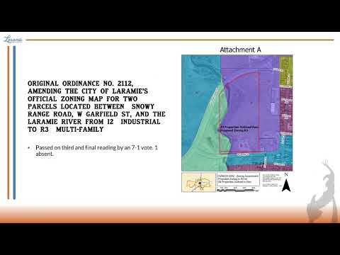
The Laramie City Council on Nov. 18 approved a series of land-use and administrative actions, including a change to the comprehensive plan's future land-use map and a rezoning of property near Snowy Range Road, West Garfield Street and the Laramie River.
In a unanimous 8-0 vote, the council approved a resolution amending Map 3.2 of the Laramie comprehensive plan to change the identified parcel's designation from "UC ' Urban Commercial" to "UR ' Urban Residential." The council noted three public comments were received on the matter during the hearing.
The council also…
Already have an account? Log in
Subscribe to keep reading
Unlock the rest of this article — and every article on Citizen Portal.
- Unlimited articles
- AI-powered breakdowns of topics, speakers, decisions, and budgets
- Instant alerts when your location has a new meeting
- Follow topics and more locations
- 1,000 AI Insights / month, plus AI Chat