Get Full Government Meeting Transcripts, Videos, & Alerts Forever!
Get email alerts on the Bridge Infrastructure topic
No spam. Unsubscribe anytime.
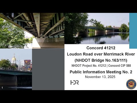
Concord unveils plan to rehabilitate Loudoun Road bridge, add 12‑ft shared‑use path
Summary
City and DOT staff presented a preliminary design to repair a ‘‘red listed’’ Loudoun Road bridge, widen sections to add a 12‑foot shared‑use path separated by a concrete barrier, improve nearby intersections and connect the Merrimack River Greenway Trail; environmental reviews and a 60% design submittal are next steps.
City of Concord officials and project staff presented a preliminary plan to rehabilitate and partially widen the Loudoun Road bridge over the Merrimack River and add a 12‑foot shared‑use path that will connect the Merrimack River Greenway Trail (MRGT) to the Northern Rail Trail.
Mike Visanson, the city engineer, opened the meeting and said the project responds to structural and operational problems. Project staff described the structure as a "red listed" bridge that needs deck replacement and pier work, and said the team aims to improve safety and multimodal access while keeping work largely within the existing bridge footprint.
The recommended design would replace the bridge deck, add girders and widen piers to support a wider deck, install a concrete barrier between traffic and a 12‑foot shared‑use path, provide 5‑foot shoulders and a 6‑foot sidewalk in places, install a raised median for opposing‑traffic separation, and update bridge and approach rail and ornamental lighting. A project presenter said the design includes operational changes at adjacent intersections (Gully Hill Road and Fort Eddy Road) including a left‑turn/exclusive lane to reduce weaving and improve alignment with the southbound ramp.
"The major component of the project is to address the bridge deficiencies. It's a red listed bridge," a project presenter said during the presentation, noting safety and multimodal access as central goals.
Structural consultants told the audience the existing steel is an older 36 ksi grade and that the design team has performed site‑specific modeling, including severe load cases and seismic checks. "We have modeled the bridge in its current state ... and the bridge will stand up," said Nick, the structural lead with the consulting team.
Staff emphasized trail connectivity: the shared‑use path would wrap under and around the east side of the bridge and provide a grade‑separated connection for pedestrians and cyclists to use instead of multiple at‑grade crossings. The project team said the MRGT connection under the bridge is feasible; a member of the public who pressed the point received confirmation from staff that the under‑bridge alignment is workable.
Project staff reviewed environmental and regulatory requirements the team must satisfy, including NEPA review (the team is pursuing a categorical exclusion), U.S. Army Corps and federal wildlife reviews, state permits such as shoreland and water‑quality and alteration of terrain permits, and Section 106 cultural‑resource review. Staff said a Phase 1a archaeological survey and an assessment of the nearby Everett Arena (more than 50 years old) will be completed as part of historic‑resources coordination.
On costs and funding, presenters showed a construction estimate breakdown and said approximately 80% of the project is federally funded and 20% would be city‑funded. A city‑funded utility relocation item was listed at $1,750,000; the team presented a combined construction total of roughly $29.06 million as the current estimate. Project staff noted costs are being re‑evaluated and that the team met with DOT estimate reviewers.
The next steps are completion of NEPA review this fall, finishing 60% design this winter, completing final design in early 2027 and advertising for bids with construction targeted in 2027 if permitting and programming proceed as planned.
Residents raised questions during an extended Q&A about structural capacity, seismic performance, snow removal on the new path, the interchange/I‑93 Exit 14 project and how it might overlap, ADA compatibility for grade transitions to the intersection, and construction staging. On snow removal, staff said municipal equipment such as a bobcat is likely to be used to clear the shared‑use path rather than allowing heavy vehicles on the path.
Ron Rayner, who identified himself during public comment, complimented the under‑bridge MRGT alignment, urged minimizing at‑grade crossings, suggested an overpass at Fort Eddy Road as a longer‑term solution and recommended considering a full bridge closure to shorten construction time. "Close it," Rayner said when urging a shorter schedule; staff responded that a full closure would be difficult to justify given traffic impacts, emergency‑access concerns and DOT approval constraints.
The presentation and meeting were recorded by Concord TV; staff said presentation materials and the video will be posted to the city's website. City officials asked the public to continue submitting comments as the design and environmental reviews advance.
What happens next: NEPA/environmental reviews and a 60% design submittal are the immediate tasks. If permitting and funding programming proceed as expected, final design would follow and construction could begin in 2027.