Get Full Government Meeting Transcripts, Videos, & Alerts Forever!
Get email alerts on the Trail Infrastructure topic
No spam. Unsubscribe anytime.
Feasibility study finds pedestrian bridge options for Eau Claire River corridor but flags wetlands, railroad and cost hurdles
Summary
An MSA feasibility study presented to the Village Parks & Rec Committee evaluated three alternatives for a multi-jurisdictional trail across the Eau Claire River; study authors highlighted wetlands, railroad coordination, geotechnical needs and estimated costs of roughly $19.2M–$22M, with DOT safety metrics cited as a key funding rationale.
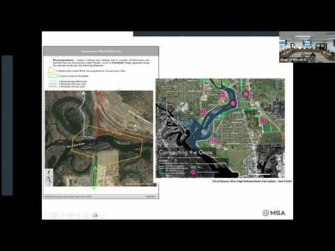
An MSA consultant presented findings from an Eau Claire River feasibility study at the Village Parks & Recreation Committee meeting, outlining three alternatives to improve bike and pedestrian access between Grossman Drive and Kent Street and to connect to Wausau’s recreational complex.
The study evaluated a no-build option and two bridge alternatives: an east-side pedestrian bridge of about 660 feet and a longer, more elevated west-side structure. Dan Borgert of MSA, who led the technical presentation, described design constraints including wetland delineation, floodplain impacts, railroad coordination and geotechnical investigation needs. "The bridge on the east side would be about 660 feet long," Borgert said, summarizing a primary sizing outcome for one favored alternative.
Why it matters: Grand Avenue carries an estimated 17,000–23,000 vehicles per day and has recorded crashes involving cyclists and pedestrians, making an alternative corridor of interest for safety funding. Borgert noted crash totals since 2014 include 24 collisions involving bicyclists or pedestrians and two fatalities, and he described DOT’s valuation method—"they value life at $10,000,000 a person"—as part of how DOT weighs safety investments.
Key findings and constraints
- Wetlands and permitting: The team delineated 21 wetlands totaling about 4.4 acres within the corridor; impacts to wetlands would likely require elevated boardwalk sections and federal permitting by the U.S. Army Corps of Engineers.
- Railroad coordination: Railroad engineers told the consultant that a west-side, elevated alternative would land too close to the railroad’s bridge footings, raising concerns about construction vibrations and safety. The railroad estimated daily flagging costs (noted in the presentation as roughly $1,300 per day) that materially increase construction costs and schedule complexity for that option.
- Geotechnical and structure needs: Both alternatives would require geotechnical borings, potential retaining walls, emergency-access design for 1,000-pound loads and lightweight deck materials such as fiber-reinforced polymer (FRP) to manage long-span weight and cost.
- Costs and phasing: The consultant’s high-level order-of-magnitude estimates placed Alternative 1 at roughly $19,200,000 and Alternative 2 at about $22,000,000. The study proposed phasing with initial connections prioritized between Schofield and Wausau and later extensions, and it described TAP (80/20) and Knowles-Nelson/Recreation Trails (50/50) as potential funding sources.
Next steps and local decisions
MSA recommended municipalities work through phasing, cost-split methodology (structure cost thirds vs. trail-length proportional splits), grant strategy and easement agreements with private landowners. Committee members were told the report had been presented to Schofield, Wausau and the Wausau MPO and that those jurisdictions expressed general support while flagging cost and interjurisdictional questions.
The presentation was informational only; no committee action was taken the night of the presentation. Committee members asked staff to invite representatives from each municipality for a future meeting if the committee wishes to pursue coordinated grant applications.
Sources and provenance: Presentation and figures appeared in the MSA feasibility briefing delivered at the committee meeting (topic introduction SEG 015; presentation wrap-up SEG 546).