Get Full Government Meeting Transcripts, Videos, & Alerts Forever!
Get email alerts on the Redistricting topic
No spam. Unsubscribe anytime.
Police Commission hears community pushback and data review as it advances proposed district boundary changes
Summary
At a March 4 community meeting, the San Francisco Police Commission and department presented proposed police district line changes — including options that would move Bayview's northern boundary to Sixteenth Street or Mariposa and consolidate UCSF into one district — and laid out a public review timeline while residents raised neighborhood and staffing concerns.
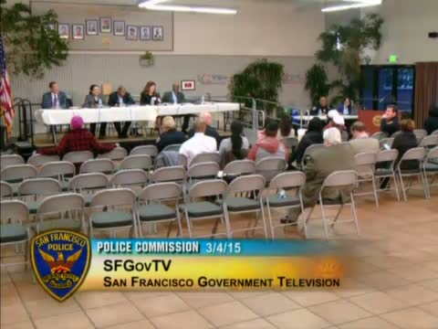
The San Francisco Police Commission on March 4 presented a proposed redraw of police district boundaries and invited community feedback on maps developed by the department and the controller’s office.
President Susie Loftus opened the meeting, saying the lines “are far from final” and that the session was the last in a series of public meetings intended to gather local input. Chief Greg Peaseur said the changes respond to a charter provision that requires review of district station boundaries to account for shifting population, workload and new facilities such as the recently built Southern District station. “We literally have to move the boundary,” the chief said, explaining the plan would place the new Southern Station in its own district and could shift Bayview’s northern edge to either Sixteenth Street or Mariposa.
Captain Rob O’Sullivan, commanding officer at Bayview Station, said the current proposal would reduce Bayview’s geographic area but not reduce its officers, and that much of the change reflects growth in Mission Bay and the planned shipyard development. “I do expect… that it really will have a somewhat minimal effect on us,” he said, while noting anticipated shipyard development could add “30 to 40,000 people per day” to the local footprint as residential and commercial uses open.
Randy McClure of the Controller’s Office walked through the project’s process and data inputs, saying the team used calls-for-service (CAD), demographics, workload measures and other variables to produce candidate maps. McClure said the work followed a structure of a city team, a consultant (Public Safety Strategies Group), focus groups and a steering committee and that the proposed map was released with a consultant report and a 90-day public comment period.
Community speakers raised several recurring concerns. Potrero Hill residents asked that the stretch of land between Sixteenth Street, Potrero Avenue and Highway 101 be assigned to Bayview rather than split, arguing the freeway is a natural divider and fragmented response hinders outreach to unhoused residents. JR Reppler, president of the Potrero Boosters Neighborhood Association, said residents prefer consolidation so UCSF falls within one station district. Visitation Valley speakers asked for better multilingual outreach and community meetings; Marlene Tran thanked Bayview leadership for monthly bilingual meetings.
Commissioners and department staff addressed operational concerns raised by residents: whether officers’ assignments would change, how sectors would be rebalanced, and whether staffing levels would be affected. Chief Peaseur and Captain O’Sullivan said officers working in a given neighborhood would generally remain the same, though they would report to the captain of the station that obtains the territory. The chief added the department expects to return recently hired officers to active patrol as staffing improves, a change that will alter distribution across districts.
The commission said it will collect written community requests, identify specific data pieces to analyze at a March 11 meeting, ask the Boston-based consultants for impact data on April 8, and — if the schedule holds — present final maps for a vote on April 15. President Loftus emphasized there would be no vote on March 11 or April 8.
The meeting closed with commissioners thanking residents for their participation and a voice vote to adjourn.
What’s next: commissioners said they will compile community input and direct consultants to model the effect of requested tweaks, with final map presentation and a vote tentatively scheduled for April 15.