Get Full Government Meeting Transcripts, Videos, & Alerts Forever!
Get email alerts on the Climate Impact Hetch Hetchy topic
No spam. Unsubscribe anytime.
SFPUC presentation: climate model projects earlier snowmelt and shifts in reservoir inflow timing
Summary
Hetch Hetchy staff presented modeling that adds +3°C temperature to historical runs and shows a shift toward earlier runoff and reduced late-spring snowmelt, with implications for summer water supply and hydroelectric generation; commissioners asked for worst-case scenario modeling and local-capture options.
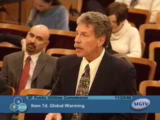
Bruce McGurk, operations manager for Hetch Hetchy Water and Power, told the commission the utility has begun basin-specific climate analyses looking ahead to 2025 and beyond. Using a conservative temperature scenario (adding roughly 3°C to historical minimum and maximum values for a scenario run), McGurk said modeled results show a rising snow line and an earlier timing of inflows that shifts the median peak inflow at Hetch Hetchy from June to May in the adjusted runs.
McGurk emphasized basin differences: Hetch Hetchy is high elevation (about 87% of its basin above 6,000 feet), making it the “last and least to be affected,” while Cherry Lake and Eleanor basins have lower elevation profiles and will exhibit earlier and larger relative change. He said his team ran 47 years of daily temperature and precipitation data, holding precipitation constant for the scenarios because climatologists provide mixed signals about future precipitation magnitude; the analysis focused on temperature-driven changes in rain-vs-snow thresholds and timing.
The commission discussed operational consequences. One commissioner noted a modeled mid-season reduction in customer-available water in a median-case example and warned of coincident timing when demand rises and stored supply could be reduced. McGurk acknowledged uncertainty in precipitation trends and recommended more detailed basin modeling, including worst-case scenarios (warmer plus reduced precipitation) and collaboration with regional districts such as Turlock Irrigation District for longer-term studies.
Next steps described in the presentation include developing more detailed conceptual models, running a wider set of scenarios including lower-precipitation cases, improving field monitoring (new precipitation and runoff gauges, upgrades to snow sensor networks), and integrating results with operational planning.