Get Full Government Meeting Transcripts, Videos, & Alerts Forever!
Get email alerts on the Treasure Island Redevelopment topic
No spam. Unsubscribe anytime.
Planning commission initiates Treasure Island/Yerba Buena redevelopment amendments after open‑space, infrastructure and financing briefing
Summary
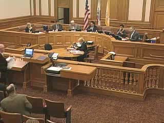
After an informational presentation on open‑space design, geotechnical remediation, sea‑level rise strategy and financing, the commission voted to initiate amendments to the general plan, planning code and zoning map to enable the Treasure Island/Yerba Buena redevelopment project to proceed to joint hearing and EIR certification.
The Planning Commission voted to initiate amendments to the general plan, planning code and zoning map for the Treasure Island/Yerba Buena Island redevelopment after receiving an informational presentation on parks and open space, infrastructure remediation and a financing plan.
Consultants and city staff presented a framework for roughly 290 acres of public open space across Treasure Island and Yerba Buena Island, including a city‑side waterfront promenade and plaza, a Northern Shoreline Park featuring wetlands and habitat restoration, a 20‑acre urban agricultural/farm park and a multi‑use sports park. Kevin Conger of CMG explained the open‑space typologies and implementation approach emphasizing a phased master‑plan framework so large parks retain integrity as construction proceeds.
On infrastructure, geotechnical consultants explained that Treasure Island was built on hydraulically placed dredged sand and bay mud; the remediation strategy combines perimeter stabilization and interior ground improvement (vibro‑compaction and deep dynamic compaction with surcharge) to reduce liquefaction and settlement risk and to enable new streets, utilities and buildings. Engineers described stormwater treatment wetlands, a new wastewater and recycled‑water plant on site, and a strategy to raise the interior grades to provide a non‑levee protected community capable of adapting to sea‑level rise. Planners presented a staged sea‑level rise approach (design to accommodate an industry‑conservative 36 inches by 2080 for interior finished floors, and perimeter adaptations staged as data require), and a funding plan combining developer capital, Mello‑Roos/CFD bonds and tax‑increment financing with an agreement to pay the Navy for the parcel.
Commissioners posed technical questions about remediation test programs, siting of agricultural uses and whether community gardens would be included, ground‑mount solar footprint and the schedule and life‑span of redevelopment financing. Staff explained that remediation and Navy environmental work remain ongoing and that specific design and detailed testing will be carried into subsequent master‑plan and sub‑phase approvals. The commission was advised that initiation does not predetermine the final approvals and that a joint hearing with the TIDA board to certify the EIR and consider the entitlements is scheduled for April 7 (subject to supplemental materials and consultant availability).
After discussion the commission adopted resolutions to initiate proposed amendments to the general plan, planning code and zoning map so the department may provide formal notice and proceed to the joint public hearing and EIR certification process. Staff emphasized the project’s financing structure includes long‑term assessment mechanisms designed to fund O&M and future sea‑level rise adaptation even after redevelopment jurisdiction sunsets.