Clark County demonstrates online parcel research tools and mapping features
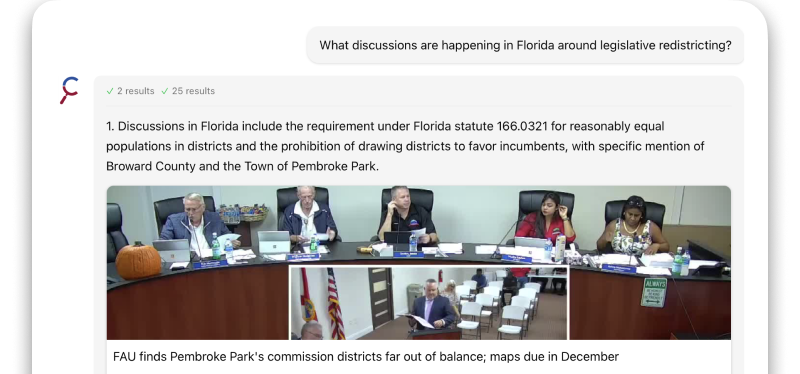
Summary
A Community Development staff member demonstrated how residents can use Clark County's MAPS Online and Property Information Center to find parcel details, historical aerials, permit records and zoning references; presenters stressed the importance of checking jurisdiction before submitting records requests.
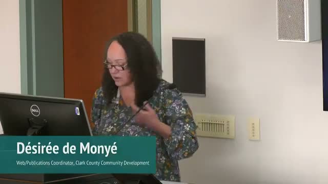
Desiree Desmonnier, a Community Development staff member, led a Learning Lab demonstration showing Clark County residents how to use the county's online mapping and property-records tools to research parcels in unincorporated areas.
Desmonnier started at the county home page and navigated to the Property Research and Records page and to MAPS Online, showing how to look up parcels by address, parcel number or tax-account number and open a property fact sheet. "Today I'm going to show you how to research online to find information and records for parcels in unincorporated Clark County," she said.
Using MAPS Online, she turned on layers for subdivisions and information icons to display recorded subdivision names and linked records; she demonstrated historical aerial imagery, noting the county has imagery as old as 1955 and later years like 1998 to illustrate change over time. She also showed environmental and topographic layers (two-foot contour lines) and building footprints; clicking an elevation contour showed a flat-area elevation example of 290 feet, which she said is the kind of information useful when preparing plot plans for building permit applications.
The demonstration covered permit-related layers and legends, including development review layers and an active code enforcement layer where case numbers and statuses appear on a parcel. Desmonnier opened a permit record that had been scanned and explained that many permit documents have been imported into the county's digital imaging system (OnBase), while older records may still exist on microfilm or paper.
She walked attendees through the Property Information Center tabs (account, building, permits, miscellaneous documents) and pointed out the issuing-agency column that shows whether a permit was issued by Clark County or by a city such as Vancouver. For zoning questions she linked to the Clark County Code Title 40 (Unified Development Code) and showed where to find setback and district standards.
Desmonnier also reviewed the county's permitting systems (LMS and Tidemark), demonstrated searching LMS by permit number and noted LMS has been in use since 2016. She advised that the availability of specific scanned records varies depending on what has already been digitized and imported.
The session concluded with a short Q&A during which attendees asked about locating traffic studies, the scope of Community Development programs and how jurisdictional changes affect records. The moderator closed the lab and announced the next session on weatherization.
The county recorded the session for CVTV and posted it to the county website; attendees were directed to the Property Research and Records page to begin searches or to submit requests through the public records portal.