Get Full Government Meeting Transcripts, Videos, & Alerts Forever!
Get email alerts on the Sub Area Plans topic
No spam. Unsubscribe anytime.
La Center reviews Timmins Landing and downtown sub-area concepts, seeks more input on commercial and access
Summary
WSP project manager Scott Kyler presented concept plans for Timmins Landing and downtown that include roundabouts, a neighborhood commercial overlay, transit access, and extended downtown mixed-use streets; commissioners asked for more analysis of access from Pollock Road, outreach to property owners, and options for structured parking and commercial expansion.
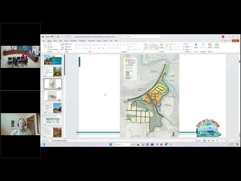
Scott Kyler, project manager for WSP, told the La Center Planning Commission the Timmins Landing sub-area concept centers on a roundabout on La Center Road, a neighborhood commercial overlay adjacent to medium- and high-density housing, transit access and wide bike-ped pathways, and pocket parks and trail connections. "Timmins Landing is a very important gateway into La Center," Kyler said, adding the plan is conceptual and could unfold over 20 years.
The plan shows a transit stop near the main roundabout, 10-foot bike-ped pathways with lighting, and a neighborhood-scale commercial node intended for makerspaces, coffee shops and similar local-serving uses. Kyler said the concept uses a flexible street template and phased infrastructure so property owners would not be forced to develop immediately.
Commissioners pressed staff and the consultant for clarifications on circulation and access. One commissioner asked whether an old city right-of-way along Pollock Road could create a direct north-south connection to Spencer Road; Kyler said the team would research historic easements and slope constraints and report back. Commissioners also raised concerns that a single primary entrance could create congestion and asked WSP to explore secondary access between the orange (high-density) and yellow (medium/low-density) areas.
Downtown concepts shown by Kyler focused on extending the grid to the west along Sixth Street and Pacific Highway, creating a mixed-use corridor and improving trail and river access. Commissioners asked why commercial uses were concentrated near the transit focal points rather than closer to the river; Kyler said the team aimed to balance market feasibility, topography and floodplain constraints while preserving trail and boardwalk areas adjacent to steep slopes.
Questions also covered parking: commissioners requested analysis of potential structured parking and possible funding strategies. Kyler said structured parking has been discussed for downtown core areas and could be supported by parking districts and grant funding, but it would be costly to implement early in the plan. He recommended lining structured parking with retail or mixed-use uses to activate street frontages.
Kyler invited additional input and noted the sub-area concepts will be taken to city council on Oct. 23. "These are concept plans and they will help frame up the types of things like zoning and streets and infrastructure solutions in the next phase of the work," he said.
Next steps: staff will compile commissioner comments and provide the presentation materials; outreach and follow-up analyses requested by commissioners (right-of-way research, detailed parcel-level impacts and parking feasibility) will be shared in advance of the council briefing.