Get Full Government Meeting Transcripts, Videos, & Alerts Forever!
Get email alerts on the Flood Resilience topic
No spam. Unsubscribe anytime.
Revere approves non-invasive flood sensors for Mills Ave and Belle Isle Marsh
Summary
The Revere Conservation Commission approved a negative determination of applicability to allow installation of grant-funded ultrasonic flood sensors at Mills Ave, Belle Isle Marsh and Remedy Marsh to provide early high-tide and sunny-day flood alerts to residents; data will be publicly hosted on the Hohonu platform.
Revere city staff and consultants told the Conservation Commission they intend to install a network of small, non-invasive ultrasonic sensors to provide early flood-warning alerts for neighborhoods near Belle Isle and Remedy marshes, and along Mills Avenue.
Kristen Hoemeyer, Revere’s resilience manager, and Justine Rooney, a coastal scientist with Woods Hole Group, said the sensors are part of a phase-two project funded by the Metropolitan Area Planning Council’s Accelerating Climate Resilience grant and the Massachusetts Coastal Zone Management FY2026 Coastal Resilience Grant. “We are here to talk about a really exciting project that has been a year in the making,” Hoemeyer said.
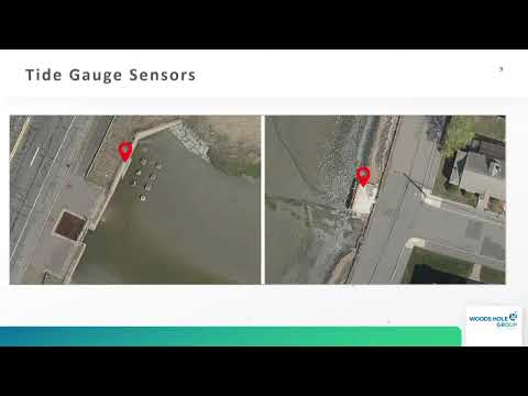
Rooney described the equipment as Hohonu ultrasonic sensors about 36 centimeters tall; they are mounted above water or on existing utility poles and bridges and are intended only to monitor water levels. “They do not fill, remove, dredge, or otherwise alter any portion of any resource under the Wetlands Protection Act,” Rooney said. The project team told commissioners the sensors are designed to be unobtrusive and to transmit data to a cloud-based platform that the city would own.
City staff said the grant covers the sensor equipment and that the planning department committed to fund ongoing platform costs in perpetuity for the two overland (utility-pole) sensors. Presenters estimated ongoing platform/data costs at about $5,000 per sensor per year; they characterized that amount as platform and telemetry costs rather than recurring equipment purchases.
The sensors will feed into a public alert system—text messages and a project landing page—so residents can sign up for warnings before high-tide or sunny-day flooding events. Rooney and Hoemeyer said outreach will include postcards and a monthly newsletter run through the North Suffolk resilience office, and the fire department is a stakeholder the city hopes to engage.
During questions, commissioners asked about solar power, batteries near water, and telemetry. Presenters said the units are solar-powered, likely rely on cellular connectivity (LTE/5G) and transmit data in near-real time; they also committed to monitoring and maintenance and to providing data and written reports to support future grant requests. Rooney noted an unconfirmed estimate that Mills Avenue had flooded “about 400 times in 10 years” and said the project team would return with a confirmed report.
After discussion commissioners moved and approved a Negative Determination of Applicability, finding the proposed sensor installations are minor and will have no significant impacts to wetlands resources under the Wetlands Protection Act. Commissioner (S3) made the motion and Commissioner (S2) seconded; the motion passed by voice vote.
The project team said next steps include finalizing sensor locations, installing signage with QR codes linking to project information, and rolling out the public sign-up for alerts. The city will document the work under the approved determination and continue outreach to neighboring communities that may benefit from shared data.