Porterville planning staff outline requirements for four‑lot Chase Avenue parcel map; fees, hydrants and driveway widths noted
Get AI-powered insights, summaries, and transcripts
Subscribe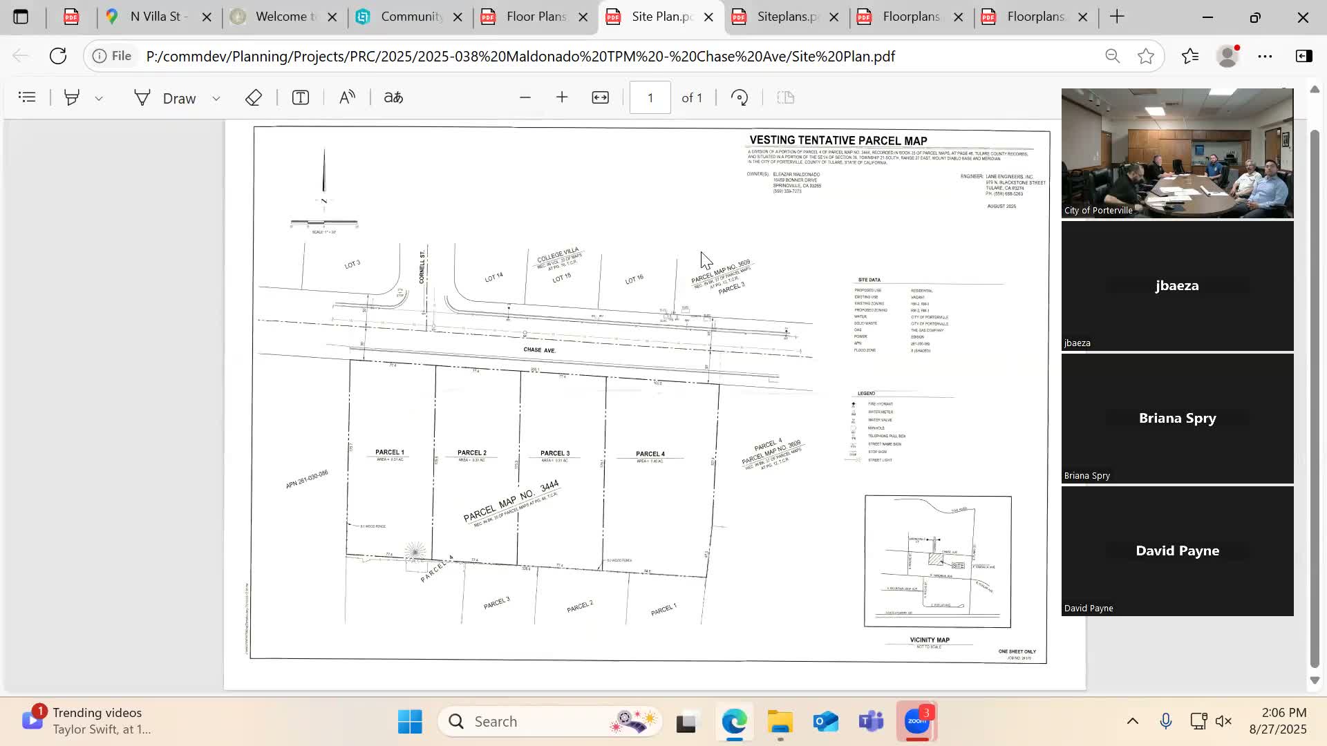
Summary
A preliminary parcel map to subdivide 1.34 acres on Chase Avenue into four lots for multifamily housing drew staff guidance on fees (tentative map $1,500), environmental filing, minimum 20‑ft two‑way driveway, 100 sq ft common open space per unit, sprinkler and hydrant spacing, and per‑lot public improvements.
At its Aug. 27 meeting, the Porterville Project Review Committee considered PRC 2025-038, a preliminary residential parcel map proposing to divide a 1.34‑acre parcel on Chase Avenue into four lots to support a future multifamily development.
Planning staff said the tentative parcel map must be prepared by a registered civil engineer or licensed surveyor, carries a tentative parcel map fee of $1,500, will require an environmental document or a notice of exemption (staff cited filing fees of $79 and $58 for those steps), and will go before the parcel map committee for a public hearing. “The tentative parcel map fee is $1,500,” planning staff said.
Staff reviewed zoning and development standards: the site is split between RM2 (medium density) and RM3 (high density). The applicant said the larger parcel could potentially accommodate about 12 units depending on setbacks; staff noted parcel lines need not align exactly with zoning boundaries and density blending may be possible.
Required engineering and design elements highlighted during the review included a minimum 20‑foot two‑way driveway (curved curb detail on the planter does not count toward the required 3‑foot landscape planter width), covered parking requirements (one covered parking space per unit plus an additional open space per unit), and a 100‑square‑foot minimum for common open space per unit. Staff also advised that storage areas must be accessible to the units and that walkways must link units to the public right-of-way.
Fire and building staff identified fire‑safety triggers for multifamily projects: a minimum 20‑foot apparatus access lane with clear marking as a fire lane, a recommended 150‑foot length for the fire lane before a turnaround is required, sprinkler systems for residential occupancies, and a fire department connection (FDC) within 50 feet of a hydrant. Fire staff noted hydrant spacing maximums for multifamily and commercial projects are typically 300 feet apart and that hydrants across the street generally do not count toward spacing requirements.
Engineering and the applicant discussed phasing of public improvements; staff said public improvements may be installed per lot as each lot develops and that developers can delay driveway approach construction until heavy construction is complete (staff suggested rock protection and typical cure times of about seven days before driving on new approaches).
No formal action was taken; staff will include these preliminary comments in a consolidated letter to the applicant and will provide detailed plan review comments during the formal submittal process.