Get Full Government Meeting Transcripts, Videos, & Alerts Forever!
Get email alerts on the Buildable Lands Inventory topic
No spam. Unsubscribe anytime.
Eugene staff outline methodology shifts for 2027 buildable lands inventory, propose 30% slope cutoff
Summary
City planning staff told the Envision Eugene technical advisory committee they will run a 2027 Buildable Lands Inventory using new 2023 lidar and parcel-specific data, keep a $1,000 assessor-improvement threshold, and continue using a 30% predominant-slope cutoff for residential/commercial capacity calculations.
The Envision Eugene technical advisory committee on Dec. 4 heard a technical briefing from Thea Evans, a senior GIS analyst in the city planning division, on how staff will run and classify lands for the 2027 Buildable Lands Inventory (BLI).
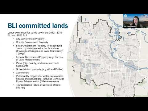
Evans said the city will run the model in January 2026 and update it in January 2027, with an effective date of Jan. 1, 2027 and adoption expected by December 2027. The BLI will classify every tax lot inside the urban growth boundary into five categories — committed, constrained, developed, partially vacant and undeveloped — and then estimate residential and employment capacity on the buildable portions of those lots. "It's going to be very technical, very in the weeds," Evans said as she began the presentation.
Staff emphasized improved data inputs. The BLI will use new 2023 lidar-derived elevation data and parcel-specific land-use and zoning designations rather than the older county-level land-use layer used in 2012. Evans said the higher-resolution lidar (roughly 3-foot pixels) makes slope and top-of-bank mapping more precise: "Now with the lidar data, it's much more precise and it allows you to really look through the trees," she said, describing consultant field checks along the Willamette River to verify top-of-bank estimates.
On steep slopes, staff proposed treating tax lots with a predominant slope of 30% or greater as 'not buildable' for the purposes of estimating future density on residential and commercial land. The state administrative rules allow jurisdictions to consider 25% as the unbuildable cutoff; Evans and staff explained they have used 30% in previous local inventories and that the change would affect a small portion of land inside the UGB. Staff told the committee that only 157 tax lots fall in the 25-to-30% predominant-slope band and that much of the UGB is already developed, so the methodology change would likely have limited effect on the overall capacity estimate.
Heather (planning staff) explained the state's role in the change: the city will run the model with both the currently effective FEMA flood layers (1999) and any preliminary FEMA data available when the model runs so the team can adjust if maps become effective during the process. She also described a planned market-factor adjustment for partially vacant land under forthcoming state rules (a "safe harbor") so the city will not necessarily assume every partially vacant parcel will redevelop within the planning horizon.
On the supply side, staff will continue to use a $1,000 assessor improvement-value threshold to separate undeveloped from developed parcels after reviewing the distribution of assessor values. Evans said lots are also screened by assessor property-class code, address points and building footprints, and automated building-footprint buffers and minimum-bounding rectangles are used to identify existing development; flags trigger manual review where shapes or ratios look anomalous.
Committee members asked for follow-up data. Several members requested that staff provide counts of dwelling units historically built on steeper slopes and a tabulation of how many additional partially vacant parcels would be considered under the proposed half-acre threshold for low-density residential partially vacant classification. Evans acknowledged that those statistics will require running the full model.
Staff said a future analysis will also separate development-ready land (served or within 300 feet of service) from land that is not development ready; that classification will feed Eugene's housing production strategy if the city lacks an eight-year supply of development-ready land.
The committee did not vote on any methodology decisions at the meeting; staff presented the proposed approach for review and said they would return with analysis and follow-up numbers once they run the model.