Get Full Government Meeting Transcripts, Videos, & Alerts Forever!
Columbia County GIS manager details drone mapping, public portals and utility safeguards
Summary
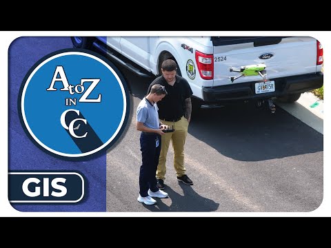
Larry Hobbs, Columbia County GIS manager, told a county presentation the GIS team uses drones, Maps Online and QPublic to support addressing, emergency response, flood mapping, 3D modeling and 311/City Works workflows. He said imagery is geo-referenced with high precision and the department has 11 staff.
Larry Hobbs, Columbia County's GIS manager, told viewers in a county "A to Z and CC" presentation that the department uses drones, public mapping portals and 3D models to support planning, emergency response and asset management.
The presentation, hosted by Cassidy Harris, the county's public relations manager, explained that GIS is the county's system for locating and describing infrastructure and community assets. "In a layman's terms ... the easiest way to describe it is Google Maps on steroids," Hobbs said, adding that GIS "is not just about representing data, but it's actually about telling a story."
Hobbs outlined core public tools residents can use: Maps Online, intended for more engineering-level mapping and terrain analysis; and QPublic, a tabular search-oriented…
Already have an account? Log in
Subscribe to keep reading
Unlock the rest of this article — and every article on Citizen Portal.
- Unlimited articles
- AI-powered breakdowns of topics, speakers, decisions, and budgets
- Instant alerts when your location has a new meeting
- Follow topics and more locations
- 1,000 AI Insights / month, plus AI Chat