Aerial imagery shows multiple beaver colonies in Rattlesnake Creek; most occupy side channels
Get AI-powered insights, summaries, and transcripts
Subscribe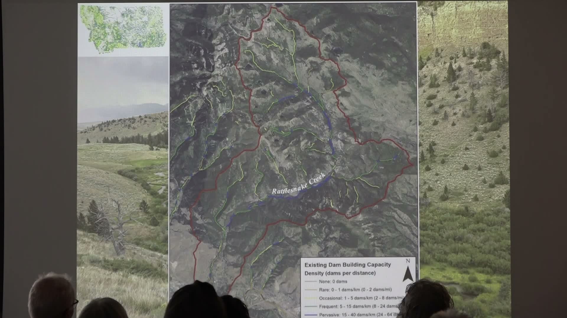
Summary
Using aerial imagery and a dam-capacity model, Tory Ritter reported finding 7–10 visible beaver colonies in the Rattlesnake Creek drainage, typically occupying off-channel wetlands and side channels rather than the main spring-runoff-dominated channel.
Tory Ritter, nongame wildlife biologist with Montana Fish, Wildlife & Parks, used aerial imagery to map beaver activity in the Rattlesnake Creek drainage and reported finding between seven and 10 visible beaver colonies.
"What I found on aerial imagery is somewhere between 7 and 10 beaver colonies along Rattlesnake Creek," Ritter said, noting that additional colonies likely exist but are not visible from imagery. He said most of the colonies he detected are located in side channels or off-channel wetlands, allowing them to persist despite high-energy spring runoff that destabilizes dams on the single-thread main channel.
Ritter described examples he reviewed from 2002 to 2025 imagery showing colonies that had been abandoned yet left behind small wetlands, and other colonies that appear to be expanding. He pointed to sites where beaver activity and natural log jams jointly promote floodplain connectivity and called out specific high-value areas (e.g., Kelly Island upstream) as beaver strongholds.
Ritter acknowledged methodological limits: he had not hiked the entire Rattlesnake Creek and relied on aerial observations and the beaver restoration assessment tool to infer activity and likely dam capacity. He invited local residents with on-the-ground familiarity to share corrections and additional observations.
The findings are primarily observational and meant to guide local monitoring and targeted site visits to confirm colony status and management needs.