Get Full Government Meeting Transcripts, Videos, & Alerts Forever!
Get email alerts on the Land Use Subdivision topic
No spam. Unsubscribe anytime.
Council continues public hearing on Juniper Muir subdivision amid access, safety and pedestrian concerns
Summary
A preliminary plat to subdivide a remainder block at Spring Mountain Ranch into five lots (SUB25-01, Juniper Muir) was continued to Sept. 25 so staff and the applicant can develop pedestrian‑access concepts and other assurances addressing neighbors' safety concerns about driveway locations on Woolly Avenue.
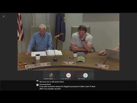
The McCall City Council on Aug. 14 continued the public hearing on a proposed preliminary plat (SUB25-01, Juniper Muir Subdivision) that would subdivide a remainder parcel in the Spring Mountain Ranch planned unit development into five residential lots. The council continued the hearing to a date certain (Sept. 25, 2025) and directed staff and the applicant to return with additional information addressing pedestrian connectivity and safety near Woolly Avenue.
Meredith Todd, city sustainability planner, summarized the application and staff review. The site falls in an R‑4 zone and, while the zone allows up to four units per acre, the applicant proposed much lower density (roughly one unit per acre). Todd said the parcel had not been previously designated as open space in the original Spring Mountain Ranch documents and that extensive topographic constraints — including a glacial moraine, rock outcrops and a wetland used for stormwater — shaped the applicant's proposed layout. She described the chosen driveway layout as a consolidation attempt to limit the number of driveways onto Woolly Avenue.
Applicant Richard Hill (joint owner with Jillian Hill) and engineer Greg Tankersley (Crestline Engineers) said the proposal aims to preserve natural features while providing low‑density infill and that alternatives (such as a full 60‑foot public right of way through the parcel) would eliminate most buildable area and are impractical. Tankersley presented sight‑distance exhibits and said the proposed driveway locations meet AASHTO standards for safe sight distance at the posted speeds; city staff confirmed sight‑distance calculations were designed for a 25 mph standard (longer than the posted 20 mph) and driveway slopes meet code.
Three nearby residents (Greg Allen, Paul Christiansen and one other commenter) voiced safety concerns. Speakers described Woolly Avenue as a busy, curving east‑west access route used by many neighborhoods, pedestrians and bicyclists; they said sight lines are limited in winter because of snow berms and argued that two driveways onto Woolly would increase hazard. Residents urged alternatives including single consolidated access, physical safety measures (radar speed signs, convex mirrors, pedestrian flashing beacons) and limiting driveway orientations so vehicles do not have to back out onto Woolly.
Planning and Zoning Commission minutes (June 3) recommended approval; commissioners noted the development was preferable to higher density alternatives and asked that buildable envelopes be shown to guide tree‑clearing and rock‑disturbance expectations. Staff confirmed no new exhibits were introduced during the applicant's rebuttal.
After extensive council discussion on the eight checklist criteria in the agenda packet (consistency with plans, site suitability, environmental impacts, easements, etc.), council requested the applicant and staff return with: (1) conceptual pedestrian connectivity for Lots 2–4 showing dedicated easements so those lots are not landlocked from the Woolly boardwalk/pathway; (2) a design or agreement to ensure vehicles do not have to reverse onto Woolly (e.g., on‑lot turn‑around or shared driveway configuration that allows forward exit); (3) options and rough cost/feasibility information for proportionate safety measures in the near term (signage, hidden driveway signs, radar speed displays or rapid‑flashing beacons) and who would be expected to fund them; and (4) a clear exhibit showing buildable envelopes and proposed easements for pedestrian access and snow/drainage storage.
City attorney and staff advised that continuing the hearing to a date certain allows the council to receive the additional facts without re‑noticing; council set the continuation for Sept. 25, 2025. The motion to continue passed on roll call with Council members Nielsen, Nelson, Machesek and Thrower and Mayor Giles recorded as yes. The public hearing remains open and staff will schedule the supplemental materials and a revised staff recommendation for the Sept. 25 meeting.